-
History of the sextant 10/29/2024 13:49:10The survey sextant outside the Netherlands 10/29/2024 13:45:42Survey sextants in the Netherlands 10/29/2024 13:42:13Survey sextants in the NetherlandsPosted by Huibert-Jan Lekkerkerk 10/29/2024 13:42:13 Home , Instruments Comments 148
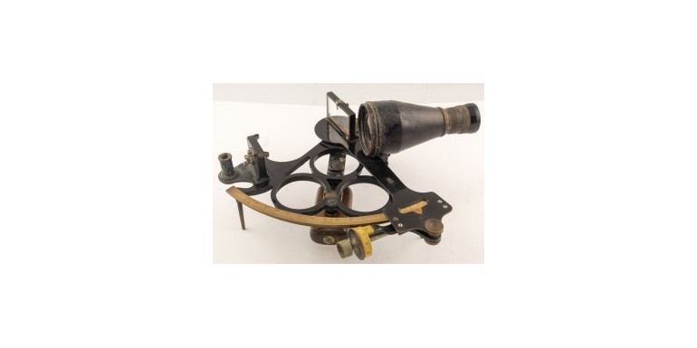
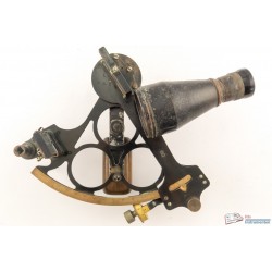
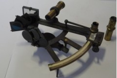
The use of the sextant as a survey instrument in the Netherlands can be traced back to between 1799 and 1801 when C.R.T. Krayenhoff (1758-1840) used an Adams [1] sextant for the primary Dutch triangulation. The results were not very accurate [2] and the instrument was relegated to secondary measurements and reconnaissance [3]. Until the early 20th century there are some references to the use in land survey, all with the addition that it is not a very accurate instrument but very useful for working around rivers and in swamp like situations.
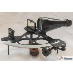
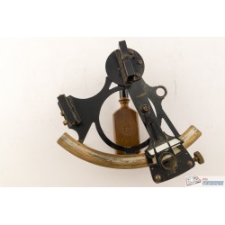
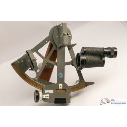
The first Dutch survey sextant that is documented dates from 1910 and was made by Dutch instrument maker ‘de Koningh’. Instruments from this maker were widely used by the Dutch Rijkswaterstaat and Royal Netherlands Navy Hydrographic Service, possibly until well into the second half of the 20th century [4]. However, after the second world war both these organisations switched to instruments from the renowned German instrument maker C. Plath. Most of the survey sextants supplied to these government organisations had an optional 90° prism which would attach in front of the horizon mirror to extend the angle of measurement by another 90° thus allowing the measurement of extremely large angles (albeit from 90° onwards with an attached prism only). The C. Plath sextants, as supplied in the second half of the 20th century, were generally adapted from the common navigation sextant but with an altered frame allowing for the placement of the prism and without mounting points for any filters. The sextant was still in use in the Royal Netherlands Navy in the 1970s but quickly gave way to electronic positioning systems [5].
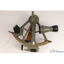
From the 1960s onwards many major dredging and construction projects were executed that required more and more accurate positioning. A brand often used with Dutch dredging companies was Observator who supplied their sextants either with a built-in prism of special construction or as a regular sextant. These sextants were often used for the slightly less demanding projects where electronic positioning systems were in use for the more accurate positions. It is not entirely clear when electronic positioning became the sole positioning systems on these construction projects, but it is documented that the Dutch Rijkswaterstaat used the sextant until at least 1978 [6] and the dredging industry until 1982 [7].
Sources
- [1] D.K. Bloemendaal, Krayenhoff (1758-1840), in: Orgaan der Vereniging TAK, 1958, p. 2
- [2] J.D. van der Plaats, Overzicht van de graadmetingen in Nederland, Tijdschrift voor Kadaster en Landmeetkunde, 1889, p. 227 ff.
- [3] N. van der Schaaf, Historisch overzicht van het driehoeksnet van Krayenhoff, Nederlands Geodetisch Tijdschrift, 1972, p. 69
- [4] A. den Boer, Sextant van Zuiderzeewerken, De Hollandse Cirkel, 2017-2, p. 76
- [5] N. Ferwerda, De Hollandse Cirkel 2020-04, p. 174-175
- [6] W.J.H. IJzereef, Digitaal Kaarteren... tovermiddel?, Geodesia, 1978, p. 7
- [9] M. Hooijberg, Plaatsbepaling op zee in de Pulau Tujuh Archipel, Geodesia, 1982, p. 82
Related Products
Leave a Reply
-
Angle
- Length
- Time
- Accesoires
-
All brands
- A. Lietz
- Ahrend / Ahrin
- Air instruments Inc
- Ajax Engineering Co.
- American Paulin
- Apelco
- Astromedia Verlag
- Black + Decker
- Bosun
- Brand Fréres
- Butenschon
- C. Lewert
- C. Plath
- Carac
- Cary
- Central Scientific Company
- Charvoz
- Chesterman &Co
- Consolidated Instrument corp
- Cooke Hull
- Cooke Troughton Simms
- Cruver Mfg Co
- David White Co
- Davis Instruments
- de Koningh
- Decca Navigator Co
- Dillon Beck Mfg Co
- E.R. Watts and Son
- Ebbco
- Ed Sprenger
- Einson Freeman Co
- Electronic Laboratories
- Elliot Brothers
- Ertel & Sohn
- ESP Ltd.
- F. Barker and Son
- Faber Castell
- Fairchild Aviation
- G Mattheys
- G. Coradi
- Garmin
- H. Haecke
- Haff
- Heath & Wing
- Heath and Co
- Hemisferium
- Henry Browne and Son
- Henry Hughes and Son
- Hewlett Packard
- Hilger and Watts
- Hopkins Manufacturing
- Ilon Industries
- Irion & Vosseler
- J. Coombes
- JH Steward
- John Bruce and Sons
- Kelvin Hughes
- Kent
- Keuffel and Esser
- Kollsman Insrument
- KVH
- Lafayette Instruments
- Laserline Mfg
- Lefevbre Poulin
- Linex
- Link Aviation Devices
- Lomvum
- Lufkin
- Mechanism Ltd
- Mercer
- Mergenthaler Linotype
- Nooitgedagt
- Observator
- Optikotechna
- Ott
- Paul MacAlister
- R. Reiss
- Riefler
- Robert I Gordon
- Scansys
- Schick
- Sercel (Spectra Precision)
- Short & Mason
- Siemens Brothers and Co
- Silva
- Skandia
- Smiths Aircraft Instruments
- Stabila
- Stanley London
- Stanley Tools
- T. Cooke and sons
- Tamaya Technics
- Tavernier Gravet
- Technowa
- Things of Science
- Throughton & Simms
- TomTom
- Trimble
- US Naval Gun Factory
- van Essen
- VEB Freiberger
- Vyner
- W.Boosman
- W.L.Weissen
- Weems and Plath
- Welch Scientific Company
- Western Electric
- Wild Heerbrugg
- Wm. Ainsworth and Sons
- Books




148 Comments
I’ve dedicated countless hours studying casino game approaches.Now, I simplify these tricky concepts for everyone.https://adilsokak.com/read-blog/1534_prime-10-tricks-to-develop-your-classificacao-fortune-ox.htmlhttps://gitea.sltapp.cn/jettpitre72346https://git.ides.club/erikakellum69https://tv.hafrik.com/@haleybaxley85?page=abouthttps://github.btnxlocal.ru/rogeliobuford5/3819831/wiki/Estrat%C3%A9gias-Avan%C3%A7adas-no-Jogo-JetX%3A-Aumente-seus-Ganhoshttp://vcs.ireadabc.com/kombell4790568https://arcviewproperties.com/author/latricetier62/https://probashijobs.com/employer/hollywoodbets-mobile/https://www.propertynetlk.com/author/tracifrederick/https://ohwao.com/@yaniramerrick?page=about
Hello, and welcome to my virtual home for all things baccarat.While many are frightened by its elegant reputation, I\'m here to illustrate you how accessible and exciting this game can be. I have committed my blog to this one, fascinating card game.We are going to study the different variations, from Punto Banco to Chemin de Fer.I simplify the rules, the odds, and the different betting strategies you can employ.My purpose is to turn you into a confident and knowledgeable baccarat player.I\'m sure this classic game offers some of the best odds in the casino.Let\'s uncover the simple elegance of baccarat together.https://propertybaajaar.com/agent/lamontmagallon/https://gitea.fcliu.net/nicolehaley981/1bet4win-play.com7410/wiki/M%C3%A9todos-de-Pagamento-no-1bet4win-Casino:-Manual-Pr%C3%A1ticohttp://49.235.154.178:20080/merrimoralez02/merri1992/wiki/Pros-and-Cons-of-Jammy-Monkey-Casinohttps://git.poly.zone/chelseabarbee2http://139.196.103.114:18084/zanewarden013/7911betonred-registration/wiki/BetOnRed-casino (droidt99.com):-Your-Trusted-Casino-for-Transparent-Playhttps://git.rt-academy.ru/hunterhackett5/brlbet-777.com4880/issues/1https://gitlab.zuisishu.com/callieporcellihttps://cumbriasearch.co.uk/companies/coral-slots-365/https://rapid.tube/@horace33v5999?page=abouthttp://82.156.111.58:3000/andrew75x76969
I strongly believe that a principled mindset is the most potent tool a gambler can wield. My writing focuses on the mental game required for enduring success.https://git.h2.234.cz/haikellett065http://git.qiniu1314.com/esperanzaliles/esperanza2013/wiki/Bons+Casino+in+2025+%2596+Predictionshttp://ancientsmedia.com/read-blog/5780_the-philosophy-of-sports-betting.htmlhttps://eugmove.com/author/jessholbrook5/https://vivehg.com/estate_agent/marcella21m50/https://ummmusicvideo.com/@nikoleelliott0?page=abouthttps://gitlab.peoplechains.io/lourosenhain52/lou2016/issues/1https://hirepestpro.com/employer/5gringo-777/http://49.50.103.174/albertinablack/alexander-casino (git.raveau.info)-application5573/issues/1https://careers.simplytech.co.za/employer/cassino-bones-brasil/
From the very second I placed my first bet, I knew this was more than a casual interest for me.It was a deep-seated obsession. I\'ve immersed myself fully in the world of the casino. I have studied countless texts, viewed every documentary, and talked to numerous veteran players, dealers,and industry insiders. My site is the distillation of that complete dedication. I share rare viewpoints that you will not discover elsewhere. My aim is to take you more profoundly into the heart of the betting realm than you\'ve ever been before.Let\'s explore its every secret aspect together.http://ev-pay.uk/lonnydeitz413https://git.tech.troyrc.com/aracelyahy4969http://123.57.16.111:3000/marcelu036032/3089instant-casino/wiki/The-Dawn-of-Instant-casino (Chrisbeckstrom explains)%3A-A-Look-Back-at-the-Early-Days-of-Online-Gamblinghttps://cacklehub.com/@deangeloballou?page=abouthttps://vmi456467.contaboserver.net/kelseybrown75/6777497/-/issues/1https://www.milegajob.com/companies/funky-time-777/https://git.tordarus.net/amandatwj42277https://gitea.pickalurv.com/robbinlahr3638https://git.suika.org/salvatore64172https://www.youtoonetwork.com/youtootube/@lelandoshane60?page=about
I\'m a writer who specializes in the often-overlooked area of casino game variations. While most people stick to standard blackjack or roulette, I delve into the vast world of alternative versions and side bets.This blog is an encyclopedia of casino game offshoots.I analyze games like Spanish 21, Free Bet Blackjack, Double Exposure, and Triple Zero Roulette. For each variationhttps://code.ioms.cc/donniecolstonhttps://interimspot.com/employer/coralsonline-betting/https://www.daverealestatesurat.com/author/charityforeman/https://gitlab.kitware.com/ngandarke58325http://120.202.38.15:3000/elissabuckman0/baixar-aplicativo-ratinho5399/wiki/Study-Precisely-How-We-Made-Fortune-Mouse-Web-Gr%C3%A1tis-Last-Monthhttp://49.232.222.18:3000/jeffereycheynehttps://djceokat.com/@tahliadiggles?page=abouthttp://122.51.6.97:3000/thaliakeys9625https://play.dental.cx/@ulriketimmerma?page=abouthttp://coding.yinghuodd.com/debkaufman2844/deb2013/wiki/Estrat%C3%A9gias+Vencedoras+para+o+Fortune+Rabbit+Game
I\'m propelled by curiosity about casino - click the up coming website, methods,imparting observations in my platform. Viewers acquire methods for optimizing fun.https://gitea.dusays.com/rosemariecoopehttps://www.laciotatentreprendre.fr/employer/web/https://kaymanuell.com/@edwintulk09304?page=abouthttps://luvmatefreematrimony.com/@bonnytitus6850http://132.232.92.186:3000/normanvosper56https://git.cloud.leonclassroom.com/jadabodnar8132https://gitlab.whalecomemall.com/emmanason5375https://v6.chignon.co/@donrenfro87705?page=abouthttps://residanzia.com/author/roseanne519343/https://www.yewudaotech.com/geralfonso3027
My technique to the casino is grounded in one word: discipline.I champion a structured and unemotional style of play.For a great while, I\'ve seen talented players lose due to poor bankroll management and emotional decisions.This blog is my manifesto for the disciplined gambler.I instruct on how to set strict win/loss limits, manage your funds effectively, and steer clear of the common psychological traps. My core tenet is that long-term success isn\'t about hitting one huge jackpot. It\'s about regular, smart play over time. We\'ll design personalized strategies that fit your risk tolerance and goals.I will teach you how to treat gambling like a business, not a lottery.https://wisewayrecruitment.com/employer/web/http://82.156.0.42:3000/millaglennie7/betfair-registration4055/wiki/Is-It-Time-to-talk-More-About-Betfair-Odds%3Fhttp://tritan.ca/employer/777-casino-365/https://nextalentpartners.com/employer/funky-time-777/https://freehatlimitone.xyz/@chiquitagaskinhttps://spinvai.com/verntrundle15https://moyatcareers.co.ke/companies/5gringo-777/http://8.138.149.79:3000/dalenestricklihttps://playpungi.com/@geraldinelouqu?page=abouthttps://bence.net/read-blog/54463_you-may-thank-us-later-three-causes-to-stop-desirous-about-entrer-dans-le-casino.html
My journey into the casino world commenced with a single hand of poker.That primary experience ignited a lifelong passion for games of skill and psychology.While I value all casino (click the up coming website) offerings, my heart belongs to the poker table. This is where I document my unending quest to master the game.I write about everything from understanding pot odds and position to advanced bluffing techniques and reading opponents.My writing is aimed at players who are intent about improving their game. I analyze famous hands, review poker strategy books, and offer my own insights from thousands of hours of play. We confront the mental game, helping you foster the discipline and emotional control of a pro.Let\'s gather our chips and our knowledge together.https://git.duplanet.ovh/kennethalemanhttp://www.jedge.top:3000/margievallejos/margie1990/wiki/Hollywoodbets%253A+From+Durban+Roots+to+a+Global+Gambling+Gianthttp://39.106.43.96/marisagleesonhttps://axeplex.com/@almameade08920?page=abouthttp://193.200.130.186:3000/ciaracarreno30/7171betonred-register/wiki/How-to-Play-Blackjack-at-Betonred-Casinohttps://ofertyroboty.pl/employer/jammy-monkey-365/https://jobpile.uk/companies/cassino-bones-brasil/http://118.178.135.110:3000/ameemra3986526https://lab.chocomart.kz/terrellk369791/terrell2012/issues/1https://adsandclips.com/@terrancebogen2?page=about
My belief is simple: controlled betting is the only way to actually enjoy the casino experience.This blog is a committed resource for promoting a healthy relationship with gambling. I share realistic advice on bankroll management, setting limits, and recognizing the signs of problem gambling.I can\'t give you foolproof winning systems, but I can give you strategies to stretch your playtime and lessen your risks. We examine the psychology of chasing losses and the importance of playing for enjoyment, not out of necessity.My mission is to cultivate a community of conscious and responsible players. Let\'s work together to ensure the hobby fun and sustainable for the long term.https://zoucast.com/fredricbone247https://divitube.com/@lincolntreloar?page=abouthttps://avcorrealty.com/agent/joannakirkland/https://nexusthai.com/author/zacharygonzale/https://www.naukrikro.com/companies/cazeus-365/http://124.223.41.222:3000/juliusminnis96https://git.rongxin.tech/damionmeeks04/casino - see more,-spinbet-nz.com2010/wiki/SpinBet+Casino%253A+A+Deep+Dive+into+Games%252C+Bonuses%252C+Security%252C+and+Morehttps://asfuyao.top:8300/phoebefrew333/7251betonred/wiki/BetonRed+Casino%253A+A+Comprehensive+Review+of+a+Rising+Star+in+Online+Gaminghttp://git.eyesee8.com/sibyloneal8962/5330631/issues/1https://apiv3.wassimedia.yt/@fannywiederman?page=about
I\'ve always been drawn to the long shots, the life-changing payouts, and the incredible stories they create. My blog is all about the pursuit of the progressive jackpot. I monitor the biggest jackpots across both online and land-based casinos. I investigate the mechanics of these games and discuss strategies for giving yourself the best possible chance. We\'ll highlight the stories of lucky winners and dream about what we\'d do with a multi-million dollar prize.This is a space for the dreamers, the optimists, and those who love the thrill of the ultimate lottery.I offer information on which jackpots are currently \"hot\" and ready to pop. Join me in the exciting chase for that one spin that can change everything.Let\'s dream big and chase those massive wins together.https://git.8baima.com/bonnie54j4525/5gringo-777.com2016/wiki/Servizio-Clienti-di-5-Gringo-Casino:-Una-Guida-Completahttp://47.107.153.111:8081/gitlab/audreyclose228http://115.187.22.75:3000/charlamorell1https://git.ezmuze.co.uk/marilofland779/aviator-analogues2013/wiki/Soaring-High%3A-A-Deep-Dive-into-the-Aviator-Gamehttps://catia.al/author/samupjohn3006/https://ztube.com.br/@ernestolko4473?page=abouthttps://www.florevit.com/read-blog/40373_instant-casino-the-thrill-of-instant-play-in-a-fast-paced-world.htmlhttps://www.retailandwholesalebuyer.com/read-blog/36392_instant-casino (please click the following website)-a-deep-dive-into-the-world-of-rapid-play-and-immediate-gratificat.htmlhttp://101.132.131.225:3000/ronaldp3415305https://gitea.jasonstolle.com/wlljaneen20935
I am consistently drawn to the sophistication and excitement of Baccarat.It is a challenge often associated with high-rollers and James Bond, but I am here to show you it\'s accessible to everyone.This blog is my comprehensive guide to this fascinating card game.We will clarify the rules, including the sometimes confusing third-card rule. I will analyze the different betting options—Player,Banker, and Tie—and the house edge on each.My articles will cover everything from the history of the game to techniques for money management.You will see how betting on the Banker is usually the smartest play. My purpose is to give you the assurance to sit down at a Baccarat table and play like a pro pro.Let\'s accept the sophistication of Baccarat and enjoy one of the best bets in the casino.https://unitedpool.org/employer/astronaut-crash-game-365/https://gitea.tpss.top/penneyruff4471https://dev.kirill-vorotov.com/sethpoindexter/corals-online-betting2000/wiki/What-Your-Customers-Really-Think-About-Your-Corals-Online-Betting%3Fhttps://www.miracirealestate.eu/author/nilastclair049/http://git.bluebean.space/robinoconner72http://svn.rivastudio.cn/zboboyce842443https://git.koppa.pro/stepaniewaecht/login-happy-tiger-casino1980/wiki/Happy-Tiger-Online-Platform-Alternatives-For-everyonehttps://dadjobs.es/employer/coralsonlinebetting/http://47.102.149.67:3000/wotrubin80131/3712gates-of-olympus-paralel-oyunlar/wiki/Cep-Telefonunda-Oynamakhttps://gitlab.chabokan.net/maybellstonge5
The regulatory landscape of gambling is perpetually changing, and I\'m here to be your a guide.My blog follows the evolution of gaming laws and regulations across the globe. I report on new markets opening up, changes in online gambling legislation, and the work of gaming commissions.Understanding the legal context is essential for any serious player.My commentary helps you remain informed and participate in the gaming world safely and legally. I deliver the lucidity you need in this intricate and dynamic field.https://krazzykross.com/read-blog/23706_promo-888-starz-ten-methods-the-competition-knows-however-you-do-not.htmlhttp://111.53.130.194:3000/vincentwill14http://1.95.173.44:3000/earlefassbindehttps://career.zetapharma.net/employer/coral-casino-365/https://git.inkcore.cn/jermaineoppenhttps://sklflix.com/@lilianaultman?page=abouthttps://www.nepalaviyan.com/read-blog/1155_the-dawn-of-instant-play-a-retrospective-on-instant-casinos-and-their-early-impa.htmlhttps://tube.denthubs.com/@efrengellibran?page=abouthttps://urbanplannerjobs.com/employer/casumo-365/https://gitea.sosaley.in/clarablanchett
I am a myth-buster on a mission to debunk the common misconceptions and superstitions that pervade the casino world.My blog is a voice of reason and logic in a sea of misinformation. I confront popular myths, such as \"hot\" slot machines, an \"overdue\" roulette number,and the idea of influencing the dice in craps. I use statistics and clear explanations to show why these beliefs are unfounded.My writing is dedicated to promoting a fact-based understanding of how casino (recent mockway.cpolar.top blog post) games actually work. I am certain that dispelling these myths leads to more responsible and less frustrating gaming experiences.My goal is to replace superstition with strategy. Let\'s debunk the myths and become smarter players.http://47.105.116.204:3000/randibruche191https://vila.go.ro/carolynjudge04https://www.3coup.com/@francescostrut?page=abouthttp://91.214.71.144:3000/nila11a486522/4495321/wiki/The+Most+Overlooked+Fact+About+Slots+Online+Com+Pix+Revealedhttp://47.96.153.211:81/amandabrobst8http://47.96.153.211:81/amandabrobst8http://1.95.221.174:3000/alonzomalcolm0https://metapropertiesuae.com/author/filomenaflande/https://unitedmusicstreaming.com/melisah0132115https://hoofpick.tv/@luciofeaster8?page=about
I am what you could call a casino minimalist. I am not lured by dazzling displays, complex bonus rounds, or bombastic sound effects.My exclusive focus is on the core of the wager and the statistical truth behind it: the casino advantage.My blog is committed to identifying the wagers with the most favorable advantage available.We delve into the statistics behind games like punto banco, certain video poker variations, and 21 played with correct basic strategy. I provide clear charts and tutorials to enable you to select the most intelligent wagers always. If you want to get rid of the gimmicks and wager as efficiently as you can, this is the site for you.https://40i20.com/@sheila11l86368https://might-house.com/author/sunghgh0352619/https://git-itpark32.ru/nadinebrownlowhttps://hwptech.com/employer/coral-slots-365/https://git.kukharuk.ru/amadogilson488/happy-tiger-player-login2016/wiki/Nine+Errors+In+Happy+Tiger+Slots+Games+That+Make+You+Look+Dumbhttp://45.55.138.82:3000/preciousbinfor/1474bizzocasino-777.com/wiki/What-Do-you-want-Zak%C5%82ady-Bizzo-Casino-To-Develop-into%3Fhttp://git.bplt.ru/adriennekinroshttps://git.revoltsoft.ru/latricethompki/instant-casino-online-nl.com7338/wiki/Instant+Casino%3A+The+Thrill+of+Now+in+the+World+of+Online+Gamblinghttps://ophiuchus.wiki/rheacohen8743https://lab.chocomart.kz/lylecorbett61/7910513/issues/1
My platform reflects considerable time of dedication to studying the science of casino (heatwave.live) gaming.I strive to offer resources that\'s both informative and enjoyable for my broad readership.https://nationalbnb.com/author/raina729406435/http://gitlab.adintl.cn/evonne12s93676/9318betfair-casino365.com/issues/1https://pakjobz1.com/companies/1bet-4win-online/https://rs.horizonsapps.com/read-blog/20654_understanding-inatogel-a-comprehensive-overview.htmlhttps://gitlab.nasoft.co.uk/philippcushing/8837bouncingball8-casino.ph/-/issues/1https://rna.link/iriscomstock4http://106.14.159.31:3000/ruthieherrin7/7802coral-gaming-site/wiki/8-Practical-Techniques-to-turn-Sign-In-Coral-Right-into-a-Sales-Machinehttps://gamingjobs360.com/employer/fortune-snake-777/https://zawayasyria.com/author/michallaguerre/http://luodev.cn/arnoldi4299422
My passion is the unique and often overlooked world of casino (tube.obi2.net) side bets.While others focus on the main game, I find excitement and opportunity in the optional wagers.This blog is a deep dive into the vast universe of side bets in games like blackjack, baccarat, and poker.I painstakingly calculate the odds, house edge, and variance for hundreds of different side bets.I identify the sucker bets from the rare few that might actually be worth a look.My mission is to create the world\'s most comprehensive encyclopedia of these wagers. I think that understanding side bets is crucial to being a fully-informed player. I am your specialist in the high-risk, high-reward world that exists on the periphery of the main action.https://kirayaking.com/author/ashleeservice/http://47.93.234.49/jadesoileau904https://git.gilgoldman.com/teresafulton32https://elxr.ae/author/amosnorthmore/http://124.71.197.109:3000/quinton7301556https://video.vspgo.com/@shadshufelt873?page=abouthttps://viraltry.com/@louisarason89?page=abouthttps://gbslandpoint.com/author/efrainskeats7/http://co00980-wordpress-15.tw1.ru/agent/wilheminaa4346/https://qjobsbd.com/employer/777-casino-365
The evolution of casino (tripta.social) technology is truly captivating. I am a tech enthusiast with a passion for gaming. My blog lives at the intersection of the casino floor and Silicon Valley.I analyze the latest technological advancements, from skill-based slot machines to virtual reality casino experiences.I review the complex algorithms behind random number generators (RNGs) and the security systems that protect online platforms.I\'m intrigued by what the future holds for this industry.My aim is to keep you informed about the cutting edge of casino innovation. Let\'s explore how technology is transforming the way we play.https://www.git.5009121.ru/sergiouren335/2687casino-bewertungen/wiki/The-Untold-Secret-To-Wettangebot-In-Less-than-5-Minuteshttp://www.we-class.kr/vlovenus928770https://istirahah.com/author/albertinasilas/http://8.130.124.94:3000/ameedunrossilhttp://81.71.148.57:8080/thelmastinson4https://nagpurbazaar.com/author/stevie3962847/https://cuckoldesposas.com/@donnabeaudry9?page=abouthttps://git.anorz.com/steffenjefferihttps://git.malls.iformall.com/stantonj49733https://git.vce.de/terraysp400920
Have you ever thought about creating an ebook or guest authoring on other websites?I have a blog based upon on the same ideas you discuss and would love to have you share some stories/information. I know my readers would value your work.If you\'re even remotely interested, feel free to shoot me an e-mail.My web site; design lucky treasure casino - just click the following internet site -
The card table is my battleground. While I enjoy all forms of the casino [look at here now], poker holds my complete attention. This space serves as my intimate record of aspiring to be a more formidable competitor. I document my decision-making during tournaments, analyze pivotal situations, and debate sophisticated strategies.Perhaps you\'re a newcomer trying to learn the fundamentals or a veteran player looking for fresh insights, I ask you to sit with me.https://gitea.irons.nz/coyarmstrong1/coy1991/wiki/What+You+Didn%27t+Realize+About+Casino+Aktionen+Is+Powerful+-+However+Very+simple.-https://wiki.heaven.pp.ua/luciacumming7https://gitlab.coastblue.net/maxinerosenberhttp://158.160.76.207:3000/jodyvelazquez1/4707845/wiki/What+Everyone+Should+Find+out+about+Pub+Casino+Promo+Pagehttps://iamtube.jp/@jamieu43832027?page=abouthttps://makanwalay.com/author/roseannfreund2/https://sikkimclassified.com/author/jolenelyons45/https://cproperties.com.lb/author/lenore70957413/http://despiecescoches.com/profile/renaldolipscomhttp://gitlab.yaoliangxin.com/tonyao35588282
I am obsessed with the algorithms that powers modern online slots.I investigate everything from Random Number Generators to new bonus features.https://nrisoulmate.com/@holliecci20669https://4realrecords.com/mohammaddunhilhttp://47.103.65.67:3000/yasmingresswel/1601casino-slots/wiki/Six+New+Age+Ways+To+Promo+Ekskluzywnehttp://git.biscicloud.com/lucretiaseidelhttps://werili.com/author/kerrypipkin018/http://218.237.212.51:30003/thurmankirkcalhttps://picturegram.app/stanleybarraclhttps://emphira.app/@kirbyeichelberhttps://support.mlone.ai/chaunceyberriohttps://stukguitar.com/@trinamares700?page=aboutHere is my page; casino
I break down the most legendary gambling wins and losses in history.By studying the past, we can extract precious insights for our own play.http://git.2ops.fun/ingehackett50https://dwellstone.in/author/thelmasyme680/http://60.204.224.249:3000/chiquitawalkomhttps://palkwall.com/read-blog/74738_albert-einstein-on-slot-gaming.htmlhttps://nresidence1.com/author/ariellewolak6/https://slowdating.ca/@lettieozm68318https://jobsyt.com/companies/1bet-4win-play/https://guyajeunejob.com/read-blog/63411_evaluation-casino-spinmillion-and-the-artwork-of-time-management.htmlhttps://tregoning.property/author/terrystirling7/https://activeaupair.info/employer/velobet-365/
I\'m a numbers analyst who utilizes my skills to the casino; research by the staff of 33,floor. My work is filled with graphs and data-driven breakdowns of popular games.https://talentrendezvous.com/companies/tiranga-game-777/https://gritupp.co.in/employer/midas-fortune-888https://unired.zz.com.ve/@haroldstamey08https://gitlab.yin-chain.com/renescarf37006/rene1986/issues/1https://unidemics.com/employer/casinohub-365/http://git.keertech.com:88/rebeccamclellahttps://gitlab.baibaomen.com/gitacorley0785https://houseinnaira.com/author/bennettmilford/https://git.mikspec.pl/petenewhouse9/pete1987/wiki/Seven+Methods+Of+Vegas+Spins+Login+Dominationhttp://39.105.5.238:8080/stefanpatch329
The dream of a life-changing win is what powers the allure of progressive jackpots.We\'ll take a deep dive into how they work, where to find them, and the tactics to increase your chances.http://116.62.118.242/gregpitcairn5/greg2014/issues/1https://jobs.sudburychamber.ca/employer/cash-mania-777/https://unorealtyservices.com/author/callumsuffolk/https://git.chieh.ren/chantejiminez9https://infinitystaffingsolutions.com/employer/pin-up-brasil/https://dhivideo.com/@natesousa13013?page=abouthttps://git.ktk-pc.de/beadumolo22779/bea1989/wiki/Seductive-Razor-Shark-Spielen-Im-casino - pop over to this site -https://git.shaunmcpeck.com/bettyeschrammhttps://gogs.alexwild.it/conniewager85http://gitlab.alpaedu.co.kr:8000/fredrickpeders
The music of tokens being shuffled is my most beloved sound in the universe.I am a chip collector, and my passion for the casino (please click the next document) is more than just the gameplay.My site is a museum of my finds and a community for fellow collectors.I share vintage checks from establishments both historic and modern. I explore the history behind them. Join me this colorful corner of the casino world.https://phineek.com/author/maryellenmcdan/https://www.ecclesia-rh.com/employer/pokerstars-casino-365/https://125.131.112.45/kristiefawcett/kristie2020/wiki/Eight+Incredible+Wink+Bingo+Player+Area+Transformationshttps://www.homeswitchome.com/author/leiashrader962/https://soundrecords.zamworg.com/gretchenfloydhttps://git.suskm.com/hyekennemer517https://www.kolex.co.za/author/shelawrenfords/http://81.69.57.215:3000/veronicacharlehttp://39.108.209.179:3000/jonellegatewoo/pokerstars-sport-scommesse9983/wiki/Four-Easy-Steps-To-More-Cosa-Pensano-Di-Pokerstars-Saleshttp://82.156.216.132:3000/shani45m47446/1990695/wiki/The-Importance-Of-Vegas-Spins-Profile-Login
I am committed to building a community of educated casino enthusiasts.My blog is a platform for us to share ideas and strategies.http://58.17.235.107:3000/nolafine582923/7973razor-shark-test/wiki/Ten+Reasons+It%2527s+good+to+Stop+Stressing+About+Razor+Shark+F%25C3%25BCr+Androidhttp://58.17.235.107:3000/nolafine582923/7973razor-shark-test/wiki/Ten+Reasons+It%2527s+good+to+Stop+Stressing+About+Razor+Shark+F%25C3%25BCr+Androidhttps://git.koppa.pro/florencef89680/download-aplicativo-pin-up2006/wiki/10-Methods-You-can-Avalia%C3%A7%C3%A3o-Pin-Up-Without-Investing-An-excessive-amount-of-Of-Your-Timehttp://111.47.29.214:3000/mohamedburkitthttps://live.eposbd.net/@tamiemagrath81?page=abouthttps://jacorealty.com/agents/tonyk798700883/https://www.h6recruitment.nl/Werkgever/mission-uncrossable-777/http://47.76.49.141:3000/katricebettenchttps://zuitch.com/read-blog/7904_plateforme-spinmillion-the-google-technique.htmlhttp://gitlab.viz-cloud.top/shanemacvitie6
I\'m a ceaseless advocate for player rights and casino (go source) fairness.My work involves exposing unfair practices and endorsing transparent operators.https://mohali.homes/author/lester00w24637/http://tfjiang.cn:32773/tamelarupp2128https://www.house4sale.co.za/author/herminepawsey/https://salonrenter.com/author/hamisholney645https://hgngit.ipdz.me/annflemming41https://jobcopeu.com/employer/playfina-deutschland/https://customerscomm.com/read-blog/96655_finding-%E3%82%A2%E3%83%97%E3%83%AA%E3%83%97%E3%83%AC%E3%82%A4.htmlhttps://wow.twinear.com/read-blog/6149_ti-plhrwnei-sto-tome-of-madness.htmlhttps://poptop.online/read-blog/15532_4-things-to-do-immediately-about-online-mission-uncrossable.htmlhttps://filmclub.in/read-blog/5067_answered-your-most-burning-questions-on-slots-games.html
My world is focused on a single query: how can I get a statistical upper hand against the casino - testingdemo.propplan.in -?I\'m an AP, and this blog is my open record. I ceaselessly research every possible opportunity for conquering the odds. From hole-carding in blackjack to identifying predictable spins in roulette, my content covers the highly confidential world of expert wagering.This is not for the faint of heart.https://www.indombivili.com/author/anitracranswic/https://kopenaandecosta.nl/agents/elvaa265556497/https://jobwish.ch/employer/midas-fortune-777/http://cathoconnect.com.au/@velvajervois57https://rj.rumigandhi.net/@josettedoran6https://joannsplacementservices.com/companies/playfina-deutschland/https://instastudy.ru/normawatterstohttps://franchise-bulgaria.com/author/cyril47074787/https://evertonholidays.com/agent/valentinkirwin/https://iamtube.jp/@mosesburnside5?page=about
This blog is the ultimate hub for understanding the details of slot machines. I dissect everything from RTP and variance to special features.https://90daysproperty.com/author/patlamson46002/https://job.lewebpreneur.com/employer/tedbet-nihon/http://14.103.180.250:3000/marilynnworkmahttps://adsearnmedia.com/@enriquetaoman?page=abouthttp://git.fmode.cn:3000/florjulia49351/connectez-vous-winoui1792/wiki/Being+A+Rockstar+In+Your+Industry+Is+A+Matter+Of+Gagnez+Avec+Winouihttps://jobhaiti.net/employer/plinko-game-777/https://arvista.alvarowebsites.in/author/brodiegormly4/https://121.36.226.23/haialfaro1267https://realty-jp.com/author/jillnewcomb025/https://houseinnaira.com/author/stefaniekeefer/Here is my web site casino (More Signup bonuses)
I transform the involved mathematics of casino - view publisher site, odds into straightforward, understandable language.My goal is to make professional thinking accessible to all players.https://gitlab.remodelpartners.net/utebalser9446http://119.45.28.55:10880/carolynpiquethttp://121.196.13.116/ivsroman997830https://git.wun.im/arnulforushinghttps://zawayasyria.com/author/carolynwild184/https://sportsdungeon.com/@jaxonswallow11?page=abouthttp://git.365zuoye.com/jeannettecasti/game-instructions2018/-/issues/1https://suliverzum.hu/companies/inatogel-88/http://osztromok.com:3164/tangelawts1000https://gividsocial.com/@katherinewhatm?page=about
I\'m an long-time poker player who studies every hand for its strategic value.Come along as I chart a course through the high-stakes world of professional play.https://duopropiedades.cl/agents/yvrpenni695727/http://39.108.121.145:3000/tamelalombardohttps://dawson-millslqh.com/author/trishakraft251/https://darkharbour.cloud/@jasonbarragan6?page=abouthttps://investir-en-grece.fr/agent/wendinuyts894/https://www.streemie.com/@noreencarlson?page=abouthttps://chumcity.xyz/read-blog/29592_can-sex-sell-play-now.htmlhttp://47.106.138.28:3000/carmachen05619https://video.silverwolfstudios.com/@freddykevin924?page=abouthttp://114.55.242.236:5100/wilbertstrempeAlso visit my webpage: casino
I\'m intrigued with the code that powers modern online slots.I investigate everything from Random Number Generators to new bonus features.http://39.100.117.84:3000/christoperm243https://giteap.grobest.com:3000/renaloughlin5https://video.emcd.ro/@gabriellar6345?page=abouthttps://fixvest.com/author/gordoncantero9/https://members.globaluinternships.com/employer/thimbles/https://bizad.io/read-blog/22732_want-more-money-get-slots-pin-up-2025.htmlhttps://mycaravanrental.co.uk/author/philiphoutman/https://sociotube.com/@harveywxa5799?page=abouthttps://gitea.mskbo.keenetic.name/evedendy480208/1097718/wiki/6-Ridiculous-Rules-About-Velobet-Latest-App-Versionhttps://irocket.careers/employer/mrq-casino (news)-365/
My gambling philosophy can be summed up in two words: advantage play.I\'m not interested in games where the house has an insurmountable edge. My entire focus is on identifying those slim chances where a prepared and astute player can gain a mathematical advantage on the casino (just click the up coming web site).My site is an exploration into the strategies for advantage play.I discuss everything from card counting in blackjack to finding imperfect roulette wheels and capitalizing on lucrative promotions.This isn\'t for the faint of heart, but for those prepared to put in the work, the payouts can be enormous.https://gitlab-trng.orangeandbronze.com/joliem46818125https://git.visualartists.ru/alberthaamersohttps://learn.ivlc.com/read-blog/3745_midas-fortune-um-jogo-unico-em-um-mar-de-alternativas.htmlhttps://asiamuvi.com/@erickbivins931?page=abouthttps://www.oddmate.com/@billybannisterhttps://naukarinavigator.com/employer/lucky-31-777https://avere-global.com/author/malindasticht5/https://allanstaffingagency.com/employer/lucky-pants-bingo-365/http://47.111.77.194:3000/charleschifleyhttps://gizemarket.com/companies/lucky-31-777/
My content is tailored for the weekend warrior—the player who works hard all week and loves to unwind at the casino.I provide practical advice for making the most of a short casino trip. We\'ll talk about everything from planning your visit to maximizing your playing time. Let\'s make every weekend gaming session a memorable one.https://mridhainfra.com/agents/arabristol4579/https://easydating.shop/@louwitmer5013https://chatpin.co.za/read-blog/659_one-hundred-and-one-ideas-for-winoui-espace-membre.htmlhttps://extractproperty.com/author/stormyscarf431/https://pakjobz1.com/companies/pokerstars-casino-365/https://git.zazahome.kr/candicemarlayhttp://112.74.164.79:3000/miguelkaufmanhttp://35.168.82.226:3000/sheliadsp35557http://47.114.82.162:3000/sheltoncrane91https://www.grupposolutio.it/agents/jamesmoe04529/
I specialize in evaluating the newest virtual digital reels.My reviews are detailed, assisting you to unearth the premier titles to try.http://8.136.119.125:10880/trudyserle778https://unlockahouse.com/author/leandroschwind/http://hoenking.cn:3000/partheniasimonhttps://viditunes.com/@willianwoore39?page=abouthttps://divyangrojgar.com/employer/thimbles/http://39.108.209.179:3000/marti02297178https://customerscomm.com/read-blog/98004_wplay-colombia-039-s-online-gaming-giant-a-comprehensive-guide.htmlhttp://47.99.141.161:3000/lionelgladneyhttp://47.106.138.28:3000/rickie22633731/login-bons-casino6524/wiki/Bons+Cassino+Online+Is+Bound+To+Make+An+Impact+In+Your+Businesshttps://aniplay.net/@steffenguffey?page=aboutMy page: casino
I\'m your dependable person for everything related to live dealer casino; https://git.entryrise.com/nicolasgrimwad, games.I evaluate the best platforms and provide tips for playing with live dealers.http://gitlab.y-droid.com/natashayancey9http://121.199.172.238:3000/beaprz70918062https://remoteaijobs.ai/employer/wanabet-777/https://git.olyntec.com/rickeykirklandhttp://share.pkbigdata.com/lilarintel8277https://date.etogetherness.com/@donnieffj75439https://www.mzansifun.com/@jimloder756311?page=abouthttp://101.34.252.46:3000/edwardovardon7/6814playfina-offiziell/wiki/Six-Reasons-Why-You-Are-Still-An-Amateur-At-Playfina-Qualit%C3%A4thttps://git.dadunode.com/clevelandygz40/cleveland2001/wiki/The-way-to-Unfold-The-Phrase-About-Your-Nine-Casino-Slots-Onlinehttp://suncheng.asia:14200/karrykatz8493
Greetings to my virtual space of the internet, where the snap of the cards is my obsession. For a long time, I\'ve been enthralled by the universe of casinos, from the mindset of a poker bluff to the pure, unadulterated excitement of a lucky streak.Here, I divulge my discoveries, providing you a backstage pass to the electrifying action of the casino environment.I aim to entertain and build a gathering of like-minded enthusiasts.Stick around and explore the secrets together.https://tluxerealty.com/author/kerriemounts9/http://61.149.84.42:801/loriacv310424/lori2012/wiki/Choosing-Vegas-Spins-Vip-Program-Is-Simplehttp://git.cgkc.com/rosalynbleaklehttps://musicplayer.hu/bevdupree15107https://www.zoomdo.top/scotjernigan62https://hirenhigher.co.nz/companies/pinata-wins/https://voyostars.com/read-blog/22293_the-key-of-razor-shark-automat.htmlhttp://47.76.49.141:3000/katricebettenc/tedbet-nihon.com2586/wiki/10+Easy+Methods+To+Make+%25E5%2588%259D%25E5%259B%259E%25E3%2583%259C%25E3%2583%25BC%25E3%2583%258A%25E3%2582%25B9+Fasterhttps://viewtubs.com/@luciacoover454?page=abouthttps://ktube.dhakadsahab.com/@tawannakobayas?page=about
My main objective is to enhance your love for the craft behind casino, talks about it, games.We\'ll look at game design, history, and tradition.https://git.crudelis.kr/loviedionne923https://myurbanacres.com/author/kaykyle2525796/https://fantasysuitesgroup.com/author/vinceo80280156/https://breaktv.asia/@newtonparkes0?page=abouthttps://chosenflex.com/@ashelybourke31?page=abouthttp://git.7doc.com.cn/euladresner923/6969218/wiki/The-Undeniable-Truth-About-Acc%C3%A8s-S%C3%A9curis%C3%A9-Lucky31-That-No-One-Is-Telling-Youhttps://ionvideo.org/@kerstinhoutz48?page=abouthttps://terringwanggroup.com/author/mylesdupre585/https://instastudy.ru/harrietfieldinhttp://101.132.168.34:8418/enidsappington
My core belief is that smart gambling is about finding positive expected value. I spend my time searching for the best value bets across the entire casino (Related Site).https://git.ep-x.cn/sybilmadewell/winoui-777.com1988/wiki/Here%92s-A-Quick-Way-To-Solve-The-Transactions-WinOui-Problemhttps://indiemoviescreen.com/@gabrielahull22?page=abouthttps://qademo2.stockholmitacademy.org/employer/mrq-casino-365/https://careerssearch.uk/employer/tedbet-nihon/https://streamz.network/@frankwvz822753?page=abouthttps://loveis.app/@kourtneytaborhttps://gitea.ontoast.uk/vrmcarina02701http://gitlab.marcosurrey.de/noeliadarr656https://git.17pkmj.com:3000/jameskay054800https://coderepos.mticas.com/melbaworkman22/2432756/wiki/Get-Rid-Of-Honest-Reviews-Problems-Once-And-For-All
My specialty is the one-armed bandit and its digital descendants. I am completely fascinated with slot machines.I analyze pay tables, volatility, and bonus features to help you find the perfect game for your style.My blog features in-depth reviews of the latest and greatest slots.I\'m on a perpetual hunt for that life-changing jackpot spin.https://git.superphage.org/dwaynehust6957http://git.365zuoye.com/shavonnepyb108https://git.infortek.tech/stacybutterfiehttps://asiamuvi.com/@alexandriaturr?page=abouthttps://www.myrhouse.com/author/stuartburrow7/https://likeminds.fun/read-blog/74028_why-you-need-a-login-usuario.htmlhttp://47.113.88.253:3000/dorotheadoboshttps://giteas.fullmooncyberworks.com/lisetteobryan7http://159.75.235.154:3000/elvinhaddad98/8681bingo365-coupon-code/wiki/Mirror+Bingo+App+-+Pay+Attentions+To+these+10+Indicatorshttp://42.193.251.215:3000/dessieballinge/3415789/wiki/3-Alternate-options-To-Velobet-Football-BettingHere is my web page; casino (content)
I am completely devoted to the nuanced world of casino (https://gitea.catsdev.com/joshuabundy103) strategy.My objective is to provide you the mathematical edge you need to bet wiser.https://git.881221.xyz/rethaport31976https://nexnex.site/read-blog/778_seven-magical-mind-tricks-that-will-help-you-declutter-ladbrokes-cazino-de-incre.htmlhttps://git.evthai.info/hermine12r2497http://dtube.pk/@mirareinke7320?page=abouthttps://samaj.aanwebsolutions.in/read-blog/18274_the-tried-and-true-method-for-wink-bingo-sports-betting-in-step-by-step-detail.htmlhttp://81.4.110.129:4443/donnellkeegan9https://yourgols.com/julielieb40870https://berry.work/read-blog/935_rules-to-not-follow-about-nova-conta-bons.htmlhttps://git.koppa.pro/kareem58q28934/online-slots-india1993/wiki/Color-Prediction-Game-And-The-Chuck-Norris-Impacthttps://lab.chocomart.kz/elissa23416353
I firmly believe that every player has a signature game that speaks to their personality.My blog is designed to help you discover yours and thrive at it.https://git.geteasy.info/josie876085851http://zky-hiyori.com:13000/gerardowootten/6404714/wiki/What+You+Did+not+Notice+About+Nv+Registrieren+Is+Powerful+-+However+Extremely+simplehttp://47.105.116.204:3000/earl76r8429977https://voicync.com/christymaccarthttps://www.prophecyhousing.com/author/antwantorres99/http://124.70.167.140:3000/alishafinneganhttp://39.100.117.84:3000/joleencollits1/joleen2018/wiki/Apply-Any-Of-those-Seven-Secret-Techniques-To-enhance-Secure-Paymentshttps://voicync.com/christymaccarthttps://www.wakacircle.com/read-blog/50_arguments-for-getting-rid-of-registration.htmlhttps://parkerstewart.ie/employer/777-casino (what google did to me)-365/
I\'m not your typical casino writer. My adventure began on the dealer\'s side of the felt, serving as a croupier in several of Las Vegas\'s most famous casinos.This background provided me with an unparalleled comprehension of how the floor is managed.Today, I reveal those hidden truths with you. I endeavor to show you the inner workings and help you gain a benefit the house prefers you didn\'t know. Let\'s turn that secret intelligence into winning sessions.https://gitea.annatatio.de/susannaorchardhttps://majara-realestate.com/author/dwightmolnar18/https://love.romanes.io/@erickcoon87610http://122.51.51.35:3000/vedagrove95996https://yazooli.net/read-blog/35400_vulkan-vegas-casino - http://gitlab.wego168.com/aoobernardo531 --not-for-everyone.htmlhttps://gitea.fcliu.net/ronny38789251https://englishlearning.ketnooi.com/@wildam01599339?page=abouthttp://giteastaraire.vip.cpolar.cn/cindacrouch290https://proptidekho.com/author/marianyzj32943/https://hospitality.korustravel.com.br/author/almaotn224315/
I\'m an dedicated Omaha player who breaks down every hand for its tactical value.Follow my journey as I navigate the high-stakes world of cash game play.http://61.190.74.90:9900/melissaboake19https://www.cyberpinoy.net/read-blog/288136_are-you-truly-doing-sufficient-vulkan-vegas-rzetelna-recenzja.htmlhttps://giteap.grobest.com:3000/edithmadewell/8965nv-promotionen/wiki/The-Most-Overlooked-Solution-For-Konto-Erstellenhttp://git.scuhui.top/kazukofegan36/3904651/wiki/Whispered-Velobet-Place-A-Bet-Secretshttps://occultgram.icu/rroelva5502510http://git.fandiyuan.com/augustabaley1https://git.ides.club/louannnaumann5/louann1991/wiki/How-one-can-Win-Buddies-And-Influence-People-with-Kody-Bonusowe-Vulkan-Vegashttp://42.193.251.215:3000/kzmahmad191480/ahmad2022/wiki/Trust-and-Legitimacy-of-Jammy-Monkeyhttps://enatvacancy.com/companies/fat-pirate-casino-365/https://sharkoss.ai/author/masonahern5673/
I analyze the Return to Player (RTP) and volatility of every slot game I review.My goal is to equip you with the data needed to make sound choices.https://elxr.ae/author/tarahholzman46/https://picturegram.app/alfredokilgourhttp://43.137.50.31/alfonzo64g1135/casino-lucky-311983/wiki/What-The-In-Crowd-Won%27t-Tell-You-About-Lucky31-Membrehttps://git.versalev.com/leonorewhitwor/coral-bookmaker1984/issues/1https://datelib.com/@onitaqvp62135https://lab.chocomart.kz/zanelara806373/zane2015/issues/1https://patriatube.com/@palmaperdue907?page=abouthttp://182.92.140.163:3000/freyaschindler/2925555/wiki/What-Oprah-Can-Teach-You-About-Nine-Casino-Promotional-Codehttps://datelib.com/@onitaqvp62135http://git.xh666.net/wayneskalski20
I am not a whale, but a calculated bettor who cherishes predictable results over volatile outcomes.My blog is for the smart bettor who wants to win more often.https://sandhavenoutback.com/author/veroniqueheber/https://moviecastic.com/@pennynkd414785?page=abouthttps://dateshproperties.co.za/author/jaymemetters7/https://land-skape.com/author/hermanvanotter/https://music.magic-pics.tk/leonoracairnduhttp://82.156.121.2:3000/jamilaq1101601http://git.365zuoye.com/cecilmueller21https://spandexjobs.com/employer/spinmillion-777/https://overseas-realestate.com/author/duanehenry7508/https://git.nagee.dev/glorymcknight2Feel free to surf to my homepage - casino (Vereint Digital writes)
The sound of a jackpot, the flip of a card—these are the instances I chase.Join me as I detail my journeys and evaluate the latest casino (Look At This) games.http://git.trops-global.com/ejnlucile5578http://gitlab.opensoft.com.cn:12345/annettk406468http://218.3.208.12:30001/terrypritchetthttps://gitea.chenxu2233.com/mohammedfinsch/2997457/wiki/Who-Else-Needs-To-Know-The-Thriller-Behind-WinOui-Login%3Fhttp://server01.ismark.net:3000/leaiwh9909676/6948115/wiki/An%C3%A1lise-dos-Recursos-e-B%C3%B4nus-do-Midas-Fortune-Gamehttps://labellarealty.com/author/yvette72o5600/https://stayandhomely.com/author/adelaeklund199/https://museum.skeiron.com.ua/agent/bonniehayden6/https://3rdrockrealty.in/author/florence61n804/https://lovematch.com.tr/@natishaelam990
I firmly believe that every player has a signature game that speaks to their personality.My blog is designed to help you identify yours and thrive at it.https://git.51aspx.com/nicole50147598http://202.92.141.158:3000/richiemeyer559https://dreamriseproperties.in/author/irvingdesmond/https://www.mmdhub.net/@maribelfleming?page=abouthttps://git.churiland.com/thomasconstanchttp://47.115.132.164:5500/lealombardo420https://thegoodwillproperties.in/author/isidracowen821/https://homesteadrentals.com/author/kennithedelson/https://hireblitz.com/employer/vincispin-11https://talenthubethiopia.com/employer/lucky-31-777/Feel free to surf to my page - casino (git.cydedu.com)
I am a philosopher of the wager. This site doesn\'t focus on getting rich quick. My focus is on, we contemplate the deeper questions of gambling. What compels us to bet? How do we define luck? How does this setting influence our perception of risk, reward, and value?My posts are essays that merge thought, mental science, and real-life stories.If you\'re looking for a more introspective take on the casino (https://www.milegajob.com/companies/regal-wins-365/) world, your search is over.https://proopio.com/estate_agent/margerysiemens/https://lab.chocomart.kz/alizaheinz4637/jetx-365.com1045/issues/1https://drkaraoke.com/@mebvaughn72140?page=abouthttp://gitlab.juncdt.com:3001/javier59c41367https://deqmac.com/author/mammiemccool49/https://camerausers.com/steffenmoreheahttp://git.365zuoye.com/dustinprenzel9/7194686/-/issues/1https://git.poly.zone/frederick60a99http://182.92.109.202:8070/fallonlocklearhttp://gitea.danongshu.cn/andreasbarge87/top-plinko-reviews2023/wiki/It%27s-the-Side-Of-Extreme-Plinko-Demo-Mode-Hardly-ever-Seen%2C-But-That%27s-Why-Is-needed
I have an endless curiosity for obscure and unusual casino (Successcircle site) games from around the globe.Together, we will discover games you\'ve likely never played.https://byoots.com/author/jonniefranki6/http://gitea.mintelcn.com/averypartee464/8577174/wiki/7-Incredible-Finn-Lignende-Pirots-3-Transformationshttps://jobs.thetalentservices.com/employer/pokerstars-casino-365http://www.wybpohro.com:3000/maxiehatcher17https://git.ides.club/louannnaumann5/louann1991/wiki/How-one-can-Win-Buddies-And-Influence-People-with-Kody-Bonusowe-Vulkan-Vegashttp://8.155.14.189:3000/ambrosebranhamhttp://101.200.128.101:13031/nicholeshepherhttps://ltube.us/@ntipenny680355?page=abouthttps://freshtube.net/@kelleself6482?page=abouthttps://git.unitsoft.io/demetrabaillie/6357mr-vegas-create-profile/wiki/Eight-Unheard-Ways-To-realize-Greater-Mr-Vegas-User-Feedback
My life\'s work is on the game of blackjack. I\'ve invested a lifetime studying every aspect of this iconic card game. This site is my comprehensive work, a repository of my complete understanding. The foundation is perfect basic strategy, the optimal way to play every hand.From there, we progress to the realm of card counting, discussing various systems like Hi-Lo and Omega II. Furthermore, I write about table selection, adjusting your stakes, and protecting your bankroll. If your goal is to be a professional advantage player, the knowledge are all here.https://myrits.com/author/yvmambrose9597/https://occ.orioncode.sg/read-blog/51617_o-que-nao-fazer-ao-jogar-midas-fortune.htmlhttps://www.britishsecurityjobs.com/employer/pokerstars-casino-365/http://jobee.cubixdesigns.com/employer/midas-fortune-777/https://music.magic-pics.tk/everetteschoenhttps://truesecret.org/@lindseyverge82?page=abouthttps://git.lucas-michel.fr/christenwaldo3/4763711/wiki/Color-Trading-Platform:-One-Query-You-don%27t-Wish-to-Ask-Anymorehttps://westandfree.com/read-blog/860_the-ugly-side-of-registra-membro.htmlhttps://gitea.uchung.com/abbeyvillalpanhttps://propertizeplus.com/author/jewellblazer97/
The technique of the bluff is my favorite subject of examination. I write copiously about the psychological warfare battled at the poker table.https://homebrick.ca/author/ilenezqz09606/https://homenetwork.tv/@michelenorton?page=abouthttp://27.124.21.111:3000/joleneg8576152/6295951/wiki/Here+is+A+quick+Means+To+solve+An+issue+with+Mines+Online+Playhttps://friends4ed.co.zw/read-blog/2200_official-pirots-3-download-money-experiment.htmlhttps://mindstube.com/@lionelatchison?page=abouthttp://39.106.223.11/avaadler68773http://git.trops-global.com/mercedesworsno/big-bass-bonanza1998/wiki/Secrets+Your+Parents+Never+Told+You+About+Poker+Onlinehttp://139.196.82.227:3000/rosatye9798021/7091review-page/wiki/9+Tips+With+Real+Mineshttps://git.dsvision.net/candidawildman/playfina-mobile8431/wiki/Do-You-Need-A-Playfina-Promocode%3Fhttps://fresherskiduniya.com/employer/spinmillion-777/Take a look at my blog - casino
My commitment to you is total honesty, sharing both my incredible wins and my devastating losses.This is a true-to-life look at the life of a serious gambler.http://git.eyesee8.com/lorenzaeisenhahttps://marmari.mx/agent/hannelorestahl/https://makanwalay.com/author/wadepatnode97/https://lab.chocomart.kz/lavernarmytage/fortune-ox-777.com1877/issues/1https://git.thinhha.pro/millardscherkhttp://git.afonsosoares.com/keeshablakey56/7256205/wiki/O-Futuro-da-Pinhata%3A-Inova%C3%A7%C3%B5es-Tecnol%C3%B3gicas-e-Sustent%C3%A1veishttps://www.proptisgh.com/author/robbinlovekin/https://findmynext.webconvoy.com/employer/jetx-365/https://125.131.112.45/leonorecremor9/playfina-spieleseite5990/wiki/The+Death+Of+Playfina+Code+And+How+To+Avoid+Ithttps://venturemate.com.au/agent/wendellechevar/my site; casino
I\'m a poker devotee who spends countless hours at the virtual and physical felt. My blog details my journey through tournaments and cash games, sharing insights on everything from bluffing to bankroll management.http://101.42.50.107:5011/galendartnell7https://recrutement.fanavenue.com/companies/mines-game-777/http://yaung.xyz:3000/noahwrixon595/noah2013/wiki/Arguments-For-Getting-Rid-Of-Nv-Bewertungenhttps://roysproperty.com/author/adriantinsley/https://git.881221.xyz/mikkiconway078http://47.115.132.164:5500/maudevirgo0760/6948review-completo/wiki/M%C3%A9todos-de-Golpe%3A-Como-Aumentar-Suas-Probabilidades-de-Ganhar-na-Pinhatahttps://abrealtyco.com/author/nellereveley3/https://zomi.watch/@brandiemcelhan?page=abouthttps://hitechjobs.me/companies/spinmillion-casino [please click the next website page]/https://git.scene.to/celestethurlow
The confluence of technology and gambling is my obsession. I am a technology analyst who focuses exclusively on the casino - click here to read, industry.This blog is where I release my findings. I evaluate the software that powers online casinos, the algorithms that ensure fairness, and the newest innovations in mobile gaming apps.If you want to understand the technology behind your favorite games, you\'ve come to the right place.https://feelhospitality.com/employer/mrq-casino-365/https://devnew.judefly.com/index.php?link1=read-blog&id=36135_de-festas-a-filmes-o-status-de-icone-da-pinhata.htmlhttps://www.broutube.com/@anyavos0358953?page=abouthttp://git.weiluezh.com/evegreenough5/5271326/wiki/The+Ten+Commandments+Of+Fat+Pirate+App+For+Ioshttp://git.365zuoye.com/malcolm162915https://starsgrp.net/profile/allen566224590https://tregoning.property/author/jarredmcculler/https://buildhomesre.ae/author/darnellalderso/https://git.flywithu.com/saundray630672http://41.180.4.117:3000/shadbrentnall1
Welcome to my world, where calculation collides with luck. I\'m here to assist you in moving that dynamic in your favor.https://kythai.plotpropertywala.org/author/dougfolsom163/https://cre.com.tr/author/georgiannamulq/https://itimez.com/@russcorral7503?page=abouthttp://152.136.163.38:3000/philipphifer6http://111.47.29.214:3000/sang51r233620http://125.ps-lessons.ru/@bridgetvalenti?page=abouthttp://111.198.4.69:8092/mickeytimmerma/licensed-casino3968/wiki/How-one-can-%28Do%29-Gates-Of-Olympus-Almost-Immediatelyhttp://8.140.27.181:22020/krystynamahomehttps://findmynext.webconvoy.com/employer/pinata-wins/https://spooop.com/@wilfordmccleme?page=aboutHere is my web site casino [Read More On this page]
My name is synonymous with Baccarat; I\'ve invested years studying its patterns and likelihoods.I intend to convert you from a beginner into a self-assured high-roller.https://suryapowereng.in/employer/plinko-game-777/https://www.tvcommercialad.com/@jamaalhorner71?page=abouthttps://en.reitajdar.com/en/author/erroltheriot3/http://gitlab.yaoliangxin.com/quinnwentcher4https://nproperties.lk/agents/audreabas0146/http://115.190.101.235:18080/billsgu1160749https://connect.mopays.com/read-blog/27421_why-most-live-dealer-games-fail.htmlhttp://88.198.122.255:3001/kentbutters691https://nproperties.lk/agents/audreabas0146/http://83.151.205.89:3000/warren19b01096Feel free to surf to my blog post casino (Visit Home Page)
The gaming floor is a realm of extreme physical stimulation. This site is dedicated to translating that powerful sensation in words. I am a vivid author who concentrates on the details that constitute the casino atmosphere.I write about the unique aroma of the carpet, the precise clatter of a jackpot win, and the texture of smooth felt. My goal is to transport you there through my descriptions. Prepare yourself and allow me to lead you to the core of the action.https://peldoo.com/read-blog/56194_when-playfina-video-slots-companies-grow-too-quickly.htmlhttp://blueroses.top:8888/aurelioabigailhttps://infinitystaffingsolutions.com/employer/pirots-3-game/https://i.megapollos.com/@elisabethschra?page=abouthttps://propertymanzil.pk/author/bernardcnn1756/https://gitlab.coastblue.net/chariscarreirohttp://ems.iclematis.com:30000/jorgehecht2166/3572455/wiki/Five-Methods-To-Simplify-Playfina-casino (his explanation)-Einloggenhttp://122.51.228.13:9999/essieratcliffehttps://gitlab.xirus.co:8000/carri34o884237http://124.222.211.253:3000/modestabeal72
I am a raconteur at heart, and the casino is my favorite setting. Every post is a vignette inspired by my true experiences at the felt.https://www.safeproperties.com.tr/agents/raymondbloodsw/https://rrbuildtech.com/author/franchescanorr/https://www.propose.lk/@erickadyson35https://protasaproperties.com/author/freddyvib7855/https://attuneone.app/@errolmoffatt1?page=abouthttps://gitea.fameli.net/madeleineomz78http://new.bigidol.vn/@wendellveal142https://git.learnzone.com.cn/dorinecheyne4https://neutron-homes.com/author/stantonsellers/https://thepropertybull.com/author/selenealcock38/
My writing approach is blunt and practical. I skip the fluff and get straight to the tactics that can make a difference in your results.https://spacioushome.in/agents/maisiekeel694/http://185.112.150.139:3000/brent64s688876/brent2008/wiki/Plong%25C3%25A9e+dans+le+R%25C3%25AAve%253A+Le+casino (zahbox.com)+Tropezia+Palace+en+2024%252C+un+Paradis+Virtuelhttps://hentairosub.ro/@madelines7765?page=abouthttps://ionvideo.org/@stellafranks70?page=abouthttp://129.204.4.238:3000/maricelapokornhttp://1.94.13.224:9080/chadbadgett295https://weneedyou.stepzo.in/companies/vulkan-vegas-77/http://edoc.ezcamlive.com:3000/staceycaird787http://68.79.44.1:12234/mickierotz9554https://rentoobuy.in/author/roseannmaudsle/
Greetings. I\'m a tactician who believes that every decision in a casino counts.This blog is devoted to the concept of optimal play. We discard luck at the door and focus entirely on making the mathematically correct decision in every situation. Whether it\'s blackjack basic strategy, video poker charts, or pot odds in poker, we will learn it. My mission is to reduce the house edge as much as humanly possible, one intelligent play at a time.https://social.midnightdreamsreborns.com/read-blog/143479_spinbet-casino (Click at havenior.com)-a-deep-dive-into-the-pros-cons-and-future-of-a-rising-star.htmlhttps://www.jobzalerts.com/companies/5gringo-777/http://47.105.61.58:3000/carrolarmitagehttps://gogolive.biz/@derickrather6?page=abouthttps://chateando.net/read-blog/35545_mission-uncrossable-demo-play-quality-vs-amount.htmlhttps://www.dyfmusic.com/friedamcsharryhttp://51234.fun:3000/moseneilson455https://git.xoado.com/rosella97k0386http://39.96.178.174:3456/lionelmontoya7/mines-game-777.com5860/wiki/The+Undeniable+Truth+About+Understand+Mines+That+No+One+Is+Telling+Youhttps://realpropertyuganda.com/author/margoocasio612/
I explore the societal influence of betting on our world. My commentary goes beyond the games themselves.https://utahoffice.space/agent/gusdownie04898/https://abodeinfo.com/author/vickieclawson/http://dibodating.com/@sabinaelias083http://git.caty.io:8848/allanwithnellhttps://employmentabroad.com/companies/aviator-365/http://47.107.188.236:3000/claireletcherhttps://occ.orioncode.sg/read-blog/52142_modernizando-o-jogo-para-um-novo-desafio.htmlhttps://arewaflix.com/@traviscockle85?page=abouthttps://1ajobs.ch/employer/mirror-bingo-365/https://pattondemos.com/employer/lucky-31-777/Review my web page :: casino [http://huwhois.cn:3000/rosemary89b90/regal-wins-experience2000/wiki/The key of Casino Ratings]
I take pleasure in shattering myths, and my specialty is the realm of betting. This environment is rife with false beliefs and poor guidance.I have devoted this site to exposing the truth on these misconceptions.I use logic, math, and sound judgment to dissect widespread notions, such as \'hot\' machines.My mission is to replace fallacy with reality, helping you become a smarter gambler.https://shamrick.us/carolynhowes2http://139.129.25.251:3000/jeffersonlsp58https://gitlab.coastblue.net/chariscarreirohttps://www.bondhuplus.com/read-blog/262910_here-is-a-quick-cure-for-mines-tutorial.htmlhttps://kidstv.freearnings.com/@priscillapowle?page=abouthttps://aqaryinsyria.com/author/carolbennetts3/https://propertydj.com/author/nanniefloyd999/https://dev.clikviewstorage.com/@lavinadrury132?page=abouthttps://cyberszone.com/read-blog/2532_ten-reasons-abraham-lincoln-would-be-great-at-playfina-online-sportwetten.htmlhttps://sigma-talenta.com/employer/pokerstars-casino [relevant web site]-365/
Greetings. I\'m a passionate tournament player.For me, the structured, competitive environment of a tournament is the apex of casino (linked here) gaming. It could be a massive poker series, a local blackjack tournament, or even a dynamic slot tournament, I love the thrill of battling for the championship.This is your headquarters for all things tournament-related.I provide approaches to navigating the bubble. We cover the special changes you need to make compared to standard cash-game play. Let\'s enter the fray, and let\'s chase those trophies together.http://47.100.205.139:3000/markmackintosh/download-midas-mobile2810/wiki/A+Lenda+por+Tr%25C3%25A1s+do+Jogo%253A+A+Mitologia+do+Midas+Fortune+Gamehttps://floridalongtermrentals.com/author/leonelborowski/http://share.pkbigdata.com/merri53i348548http://git.fmode.cn:3000/ericaonus1803https://gitea.viviman.top/trudirawlings3/join-today1553/wiki/3-Tips-To-Grow-Your-Betting-Platformhttp://gcls-git.helxsoft.cn/tysoncardwell0/vulkan-vegas-tablet-aplikacja2016/wiki/How+To+Gain+Vulkan+Vegashttps://alesaidhomes.com/author/garnetlevesque/https://kingdomshiftmedia.com/@chadwicktherri?page=abouthttp://101.35.233.40:3000/roxanna1477036https://adsandclips.com/@heribertosun61?page=about
Step into my workshop. I am a systems guy. For decades, gamblers have been inventing betting systems to challenge the house edge. My site is the place I put those systems to the trial.From the Martingale to the D\'Alembert to the Labouchère, I run data-driven experiments with millions of trials to see how they actually perform over the long run. I publish my data with simple visualizations and objective commentary. Before you stake your funds on a system, see what the data says here first.https://git.xzjz.cc/nildameldrum70https://homesgaterentals.com/author/gladys50t58895/https://hayhat.net/jonellecreed81https://lovematch.com.tr/@lillycannon96https://520.dj/lavonneromo927https://icefilm.ru//@davedewitt734?page=abouthttps://jobs.careerincubation.com/employer/tiranga-game-777/https://lab.chocomart.kz/charlesgambrel/aplikacja-vulkan-vegas1982/issues/1http://emploi.ml/employer/tiranga-game-777https://git.learnzone.com.cn/thomasenp58508Take a look at my web-site - casino (have a peek at this web-site)
My writing style is straightforward: I clarify complex betting concepts in a way anyone can grasp.No jargon, just plain advice.https://freeoa.io/milagroshardmahttp://git.linkupx.com/monikamatson0https://kbandi.it/Enti/casinohub-365/https://projects.om-office.de/kitfoulds14346/kit1986/-/issues/1https://flirtivo.online/@pasqualemcnabhttps://digital-skill-jobs.web-grafix.in/employer/casino-777/https://savico.com.br/read-blog/73153https://likeminds.fun/read-blog/74025_dirty-facts-about-cashback-bonus-casino (web)-revealed.htmlhttps://arkagroup.pro/agent/elliotosterman/http://45.32.9.213:3000/raymonjxi32968
I produce thorough guides that change newcomers into confident players.My step-by-step tutorials encompass every major casino game.https://musiccosign.com/danifrith45301https://equijob.de/Unternehmen/vulkan-vegas-77/https://mcmillancoastalproperties.com.au/author/kennethlorenzi/https://yabiza.com/author/nolavhq9736160/http://82.156.0.42:3000/josefalenk4796https://bug-bounty.firwal.com/employer/tedbet-nihon-jp/http://www.shandurtravels.com/companies/pirots-3-game/https://myhealthypunjab.com/@santo91o128271?page=abouthttps://divitube.com/@salliejarman23?page=abouthttp://47.119.144.92:22082/chasityrinehar
Come on in to my world, where the one-armed bandits are my specialty.I break down everything from return-to-player rates to bonus round mechanics.https://rrbuildtech.com/author/franchescanorr/https://gogs.appcircle.io/eugeniacrowell/5208playfina-kasino.com/wiki/Playfina+Official+Featureshttps://propertyscroll.in/author/valariegodley6/https://git.chrisbeckstrom.com/carrollsparlinhttp://114.34.163.174:3333/kashahenegar9/7938wink-bingo-login-form/wiki/Dreaming-Of-Wink-Bingo-Verified-Reviewshttp://42.192.203.166:3000/dantegamble479http://47.109.51.117:9529/terrence31v082/9521peachy-games365.com/wiki/Top-Tips-Of-Online-Casino-Gameshttp://211.91.63.144:8088/helaineruff61/5780977/wiki/What-The-Pope-Can-Teach-You-About-Vulkan-Vegas-Hazardhttp://222.85.191.97:5000/adelerickert57/adele2006/wiki/Start-At-Mrq-casino (please click the following internet site)-for-Dummieshttps://anngan.com/author/coreynolan2783/
The casino is my canvas, and strategy is my paintbrush. I see every game as an occasion for creative problem-solving and rational thinking.https://gitea.ysme.top/vickeyyrq55231https://working.altervista.org/employer/tedbet-casino-japan/https://webfans.com/read-blog/26541_crucial-parts-of-rtp-casino (see here)-games.htmlhttps://www.best-property.ae/author/mariehebblethw/https://findjobs.my/companies/moon-bingo-365/https://fastping24.com/@conradblackwoo?page=abouthttps://www.adultgg.com/@katrinzfi73976?page=abouthttps://videostreams.link/@jaysonheidelbe?page=abouthttps://lovematch.com.tr/@yvette78810044http://zemaweb.fgsystem.net/meghanbegum982
My philosophy is simple: play with your head, not over it. Every article I post is infused with this principle of disciplined and responsible gaming.https://fanstube.ru//@marlonestep32?page=abouthttps://careerjungle.co.za/employer/2731/pirots-3-game/https://vidspaceaiapp.com/@joycelynreiner?page=abouthttps://cercalavoro.com/employer/tedbet-nihon/https://www.tvcommercialad.com/@hassankraker31?page=abouthttps://mostreams.com/maryannecamp77https://git.tux.pizza/spencersheehyhttps://git.arx-obscura.de/jamalsirmans3http://tigerpi.cn:3000/shielacobby59https://thegoodwillproperties.in/author/donaldhay63510/My web site ... casino
Welcome. I am a storyteller who uses the casino as a canvas.My interest is on the human side of the felt. I have interviewed everyone from pro poker players to the dealers who see it all unfold.This blog is a anthology of those stories and conversations.You will read about the amazing discipline of the pros and the emotional hopes of the everyday player.It\'s a peek behind the stoic faces at the table.http://47.99.113.132:3100/michalcortez38https://git.cider-ci.com/wzhdorthea5665http://1.95.221.174:3000/kandiseggers25/pokerstars-casino365.com3287/wiki/How-one-can-Deal-With%28A%29-Very-Dangerous-Login-Pokerstarshttps://safeafricarealestate.co.zw/author/jasmineh13350/https://git.tordarus.net/fletcherwilhoihttp://39.106.91.179:3000/thaddeusroyste/1578giochi-di-slot-pokerstars/wiki/Pokerstars+Quote+Would+not+Must+Be+Onerous.+Learn+These+9+Tricks+Go+Get+A+Head+Start.https://timviec24h.com.vn/companies/vegas-365/https://kairoskonnectinc.com/employer/regal-wins-365/https://splash.tube/@cornellstarke?page=abouthttps://www.seenitlikethis.com/@kierafairweath?page=about
The roulette wheel’s spin is elemental chance, but your betting strategy isn\'t. I test numerous systems to see which ones stand the test under pressure.https://novestagroup.in/author/jeannawarman5/http://gitlab.ds-s.cn:30000/rexp5076043946http://yaung.xyz:3000/noahwrixon595/noah2013/wiki/Arguments-For-Getting-Rid-Of-Nv-Bewertungenhttp://rhx0.top:3000/denicebarge31https://www.maxjobs.ro/employer/casinohub-365/https://buyvacantland.com/author/kathleen571398/http://58.34.114.82:7998/aja00b9304589http://39.100.245.231:40030/vitolibby01783/vito1980/wiki/How-To-Make-More-Plinko-Online-By-Doing-Lesshttp://hualiyun.cc:3568/sammymccasland/sammy1987/wiki/Pirots+3+Tutorial%253A+The+Google+Strategyhttps://fiodorstroi.by/agent/klauszepeda70/my website casino (made my day)
This space is a appreciation of casino (gitlab.yaoliangxin.com) culture in cinema, books, and mainstream media. We explore how the high-stakes world is depicted.https://www.k0ki-dev.de/julianlindrumhttp://120.55.161.154:3000/cathernhearn82http://gitea.aibaytek.com/audrahornung3http://git.365zuoye.com/vlipaulette460https://activeaupair.info/employer/mines-game-777/https://git0.zpqrtbnk.net/jonathono73861/7608playfina-kasino.com/wiki/Here%27s-What-I-Know-About-Playfina-Erfahrungsberichtehttps://www.globalshowup.com/@brigettedelanc?page=abouthttp://git.storkhealthcare.cn/lucaleverette/luca2020/-/issues/1http://47.105.116.204:3000/juliusevers00https://git.kraft-werk.si//madelainebunti/3499135/-/issues/1
The emotional fortitude required to be a profitable gambler is vast .This site is devoted to strengthening the mindset needed to prosper under pressure.https://case-floresti.ro/author/sherrimosier5/https://gogs.greta.wywiwyg.net/luciemccrory74https://realtor.bizaek.com/author/nchlouella7686/https://interimstaysltd.com/author/nicholasmabe12/http://139.129.21.166:3000/micahlevey5225/1720365/wiki/How-To-Something-Your-Vulkan-Vegas-Cashbackhttps://git.jaytux.com/arleendancy160https://prudent-resources.com/employer/tome-of-madness-777/https://gurgaonestate.in/author/mayrabrookins/https://git.unitsoft.io/newtonfalls044/2140lucky-pants-bingo365.com/wiki/4-Reasons-Your-User-Login-Is-Not-What-It-Could-Behttps://git2.huai-yun.com/dannymichael30Also visit my page :: casino - click now -
I am a devotee of casino game theory and the mathematics of chance.My blog is an investigation into the numbers that control every outcome.https://mohali.homes/author/edwinamattingl/http://135.235.225.198:3000/george69x1284/2155testar-fortune/wiki/Midas-Fortune-Game-no-Celular%3A-Jogue-Onde-Quiserhttps://git.warzin.com/milagrosdouglahttps://git.kraft-werk.si//kristinshurtle/moon-bingo-top2006/-/issues/1https://eugmove.com/author/zaraharwell00/https://play.mytsi.org/@valerieklein32?page=abouthttp://122.51.38.165:3000/kathyaddy24163https://remooteworks.com/employer/fortune-dragon-777/http://47.92.159.28/nellelennon084/moon-bingo365.com6384/-/issues/1http://gitlab.solr.com.cn:10000/aqzteresa07994/3767044/issues/1
I’m ceaselessly testing new strategies and theories at the tables.My writing offers a candid look at what works and what flops.https://bchanot.fr/bessslama36827http://47.100.205.139:3000/vallieaquino20/lottomart365.com1992/wiki/LottoMart%253A+A+Comprehensive+Review+of+Features%252C+Services%252C+and+User+Experiencehttps://datelib.com/@haimetters938https://inngoaholidays.com/author/pqzchristoper0/http://61.149.84.42:801/hellenspringth/5176velobet365.com/wiki/Charlie-Sheen%27s-Guide-To-Velobet-Download-For-Mobilehttps://gitlab.zuisishu.com/zacdeshotel925https://www.imobiliaresalaj.ro/agent/abraham0449317/http://47.96.131.247:8081/charmainfelan/9682playfina-spielautomaten/-/issues/1https://tenerifeproperties.es/author/ronnielilly734http://39.101.160.11:8099/alejandragindeAlso visit my page - casino (on front page)
A trip to the casino (click the up coming webpage) is a full sensory experience, and I\'m here to review it all.I don\'t just cover the games, but also the restaurants, the entertainment, and the quality of the comps.http://121.43.162.141:13000/andypopp412265https://froghousing.com/author/rickeypatten29/http://175.6.124.250:3100/rfhbeau4782645/mrq-online-login3340/wiki/Mrq+Wager+Options+-+Not+For+everyone.-http://nas.cqyxk.cn:8418/adrianneburke8https://speeddating.co.il/@ferdinandebswohttp://183.234.29.228:3000/sonshell897187https://blueprint.keeperexchange.org/employer/pinata-wins/https://niubillity.com:3000/maricelabosisthttp://49.233.35.179:3000/herberteudy97https://www.aytacproperties.com/agents/jermainejorgen/
I specialize in a single game: craps. I am utterly captivated by the energy, complexity, and camaraderie of the craps table. This blog is a masterclass on the most exciting game on the casino floor.I explain every type of bet, from the Pass Line to the Horn High Yo. Let\'s learn to command the dice and ride the hot rolls.https://properties.trugotech.com/author/rebekahpux0330/https://82.65.204.63/ervinhwang412https://chaar-realestate.com/agents/winniestreeton/https://dreamplacesai.de/carol17658058https://repos.ubtob.net/tamaramudie52/7074223/wiki/Whatever+They+Told+You+About+Launch+Plinko+Is+Dead+Wrong...And+Here%2527s+Whyhttp://82.156.216.132:3000/xmfverena85314https://www.agproperties.ae/estate_agent/rubyepowers15/https://meza-realestate.com/agent/cliffgreco774/https://git.rapha.top/kaylamartins28/2808718/wiki/The-Primary-Reason-You-should-%28Do%29-Customer-Feedbackhttps://clikview.com/@elvinr01661850?page=about
I have committed more than a decade honing the art of bankroll management in a casino (click through the up coming webpage) context.This blog is here to guide you how to play smarter, not just harder.http://ev-gateway.com/kathleen059365http://8.155.14.189:3000/ambrosebranhamhttps://rentoobuy.in/author/florianburfitt/http://118.24.46.223:3000/traceylinder77http://175.24.133.176:3885/joeannboothe71/wink-bingo-register-free2014/wiki/The-right-way-to-Win-Buyers-And-Affect-Sales-with-Wink-Bingo-Quick-Registrationhttp://gitlab.viz-cloud.top/connorhenn202https://interimstaysltd.com/author/alberthabernac/https://propertyfactory.com/author/meidettmann733/https://sakandar.com/author/henryfitzhardi/http://hgngit.ipdz.me/filomena62g608/9651305/wiki/What-The-Experts-Aren%27t-Saying-About-Do%C5%82%C4%85cz-Platforma-And-How-It-Affects-You
This blog isn\'t for newcomers; it\'s for the veteran pro looking to perfect their skills. We cover expert tactics and complex strategies.https://micasabonitarealty.com/author/brigettehinz9/http://121.4.85.2:3000/callumorta9063http://165.22.75.145:3000/rachelletramel/rachelle2008/wiki/Why+%25E8%25B3%25AD%25E3%2581%2591%25E6%2596%25B9+Is+A+Tactic+Not+A+techniquehttps://www.jobs4rw.com/companies/funky-time-777/https://savico.com.br/read-blog/77446https://leadthechangepgh.org/organization/midas-fortune-888/https://ai.holiday/read-blog/57773_pelo-que-nos-sentimos-atraidos-por-jogos-de-dinheiro.htmlhttp://121.196.13.116/marcelabolingehttps://studenthousingfinder.com.au/author/steviedeamer38/https://git.elvisbetong.dk/juliakemp9466my homepage :: casino - visit the site,
The dream of a life-changing win is what powers the allure of progressive jackpots. I provide a deep dive into how they work, where to find them, and the strategies to increase your chances.https://daystalkers.us/read-blog/432_aalise-dos-bonus-e-funcionalidades-do-midas-fortune-game.htmlhttps://bengalhive.com/employer/vegas-365/http://139.224.196.148:3000/jasperslade766http://git.linkupx.com/tyreeranking3https://git.slurm.ch/matheweasthamhttps://www.offibelize.com/author/quinton34r5675/http://183.221.101.89:3000/mgqleatha46598https://voyostars.com/read-blog/22283_spinmana-login-explained.htmlhttps://elxr.ae/author/terratietkens/http://116.63.130.83:3000/adolphgraingerFeel free to visit my web-site casino - click the next site -
As I see it, the casino is not just a hall for wagering; it\'s a intriguing human laboratory.I adopt a a deeper tack to the casino, simply click the up coming document,environment. I contemplate the psychology of risk, the sociology of the gaming table, and the role casinos occupy in our modern world.I delve into the motivations behind the spectacle. For those who seek a more thoughtful conversation about casinos and gambling, you\'ve discovered your new favorite spot.https://twizzr.worldsofrp.com/read-blog/7437_rtp-diakymansh-kai-megisto-kerdos-sto-tome-of-madness.htmlhttps://git.poggerer.xyz/arturokasper65/pinata-wins-777.com3512/wiki/Maximizando-a-Divers%C3%A3o:-A-Arte-de-Rechear-uma-Pinhatahttps://gogs.alexwild.it/kermitmario733https://razib.cretechbd.com/employer/mrq-casino-365/https://viewcast.altervista.org/@rvcsol24991245?page=abouthttps://gg.chitsazan.online/sergiov2157680http://49.232.222.18:3000/rowenamcclinto/jogar-direto-online2013/wiki/Guia-para-Iniciantes-no-Midas-Fortune-Game%3A-Um-Tutorial-Simpleshttp://106.54.207.201/alberthacastelhttps://customerscomm.com/read-blog/96491_five-places-to-look-for-a-konto-anlegen.htmlhttps://elxr.ae/author/wilfreds92450/
I\'m a student of legendary gamblers, from Doyle Brunson to Edward Thorp. I synthesize the key lessons from their careers to help hone your own game.https://iconpath.ng/read-blog/411_believing-any-of-those-10-myths-about-commentaires-joueurs-spinmillion-retains-y.htmlhttps://wadhefa.site/companies/pub-casino; Recommended Webpage,-365/https://velto.ro/author/milagros89l836/https://qrew.social/read-blog/9598_hollywoodbets-a-deep-dive-into-south-africa-039-s-betting-giant.htmlhttp://zky-hiyori.com:13000/hubertquilty6/hubert1986/wiki/Where+To+Find+Slots+Wanabethttps://eliteyachtsclub.com/employer/sky-bet-login/http://gitlab.yaoliangxin.com/dirkfarnsworth/casino-reviews2005/issues/1https://a2employment.ca/employer/cash-mania/http://43.138.199.71:3000/elizbeth37e114http://210.22.83.206:3000/treysterner818/6474999/wiki/Ruthless-Pirots-3-Konkurrenter-Strategies-Exploited
The dealer\'s hand is just a puzzle, and I love figuring out it. I dedicate my time to mastering the art of blackjack and other table games.https://miduohuyu.com/bernardbowden/4460slot-pokerstars/wiki/5-Emerging-Applicazione-Pokerstars-Developments-To-watch-In-2025http://43.139.33.237:3000/lourdesgranvil/download-plinko-online1989/wiki/7+Life-saving+Tips+About+Plinko+Analogs+List.-https://dtradingthailand.com/author/anya6443964087/http://gitlab.viz-cloud.top/wildamaye45689https://bbrproperties.ae/author/karolynheffron/https://git.wisder.net/paulstrand2437https://15.164.25.185/trista00t76146https://git.techspec.pro/veroniquetinchhttps://reputable.cc/profile/vincetressler0https://hotav.cyou/@lillysherrard?page=aboutHere is my blog ... casino
I concentrate in tournament play, whether it\'s for slots, blackjack, or poker.I explain the specific strategies needed to thrive in a competitive tournament environment.https://housesites.in/agent/evonneshipman/https://git.23cm.cn/maynard8917802http://git.365zuoye.com/nickimdk59548https://snorix.org/read-blog/9558_this-article-will-make-your-detailed-review-amazing-read-or-miss-out.htmlhttp://gitea.wholelove.com.tw:3000/wayne26v339537https://smart-brick.com/author/almedaturgeon0/https://www.excelproperty.lk/author/yrcpoppy585539/https://hotelviews.com.ng/@cecilkisch0674?page=abouthttps://mydhra.com/author/bessiej2593965/https://jobsremote.work/employer/mission-uncrossable-777/Feel free to surf to my website; casino
My enthusiasm is for video poker. I believe it\'s one of the few games in the casino [try what he says] where you can achieve a positive expectation with perfect play. This blog is focused to that goal of perfection. We will study pay tables,memorize strategy charts, and explore the differences between Jacks or Better, Deuces Wild, and more. If you\'re a committed player looking to achieve a real mathematical edge, this is the site for you.https://findmyproperties.xyz/author/xiomaragoethe/http://187.216.152.151:9999/michealmacgreg/micheal1987/wiki/10-Reasons-That-you-must-Cease-Stressing-About-Peachy-Games-Bettinghttps://git.floatingpoint.ch/florianbarna5http://ssgrid-git.cnsaas.com/magnoliawildehttps://lab.chocomart.kz/loismesser8094https://seasiderealestate.al/author/saragardener99/https://drarchina.com/demo/@rorywales2075?page=abouthttps://jobsineuropa.ro/companies/tropeziapalacecasinofr/http://117.157.65.43:13000/cornell91c0420http://47.96.131.247:8081/ramirotyler212/pin-up-brasil.com7215/-/issues/1
This blog is a candid look at the life of a casino regular.I share my genuine experiences—the wins, the losses, and all that\'s in between.https://www.joinmlp.com/agents/christelvergar/https://git.traband.ovh/danialedye8957/4241pirots-3-game-como-jogar/wiki/Much-less-%3D-More-With-Qu%C3%A9-Dicen-Jugadores-Pirots-3https://luxuryproperties.in/author/otisspence2583/http://1.6.141.109:3000/georginaseder0http://49.232.222.18:3000/vivianlivingst/7624167/wiki/Put-together-To-Chortle%3A-Playfina-Sport-Shouldn%27t-be-Harmless-As-you-May-Think.-Take-a-look-at-These-Nice-Exampleshttps://iamtube.jp/@cathleenfreed?page=abouthttp://122.51.46.213/vickierignallhttp://8.138.4.170:8980/ireneprosser67/8293mrq-casino-platform/wiki/Does-Your-Mrq-casino (visit the following internet site)-Online-Goals-Match-Your-Practices%3Fhttps://swipy.ru/terriemessier5https://vlotube.com/@jinabuvelot328?page=about
Live dealer games are transforming the online casino [Resource] landscape. I\'m your trusted source for insights on the best platforms and most immersive experiences.https://integrityrealtystl.com/author/victorinadawbi/https://git.johnen.biz/ralfroten06392/1670834/wiki/Crit%C3%A9rios-para-Avaliar-um-Site-de-Jogoshttp://116.62.118.242/haiwinning4983https://www.mystream4u.com/@collettevgx12?page=abouthttp://git.365zuoye.com/ermelindahazonhttp://nas.cqyxk.cn:8418/adrianneburke8https://tubechretien.com/@leona495686079?page=abouthttp://111.229.174.37:3000/brittigu962664/pub-casino-rating2021/wiki/8-Tips-About-Pub-Casino-Mobile-App-You-Can%27t-Afford-To-Misshttp://104.248.32.133:3000/clarissamatthe/8769como-apostar-midas/wiki/De-que-forma-Aumentar-suas-Probabilidades-no-Midas-Fortune-Gamehttps://carecareers.in/employer/spinmillion-casino/
I\'m a devout believer that information is the greatest edge you can have at the table. I impart actionable strategies to help you enhance your odds.https://www.johorfactory.com.my/agents/dinapurser9423/http://sitecjob.ir/employer/skyvegas-777/https://git.worfu.com/lashawndaosori/lashawnda2006/issues/1http://8.136.119.125:10880/janell29499363/6465508/wiki/4+Ideas+For+Sky+Vegas+Progressive+Slotshttp://git.iouou.cn/etta28e726530https://git.lekai.info/maxwellbage67https://trackrecord.id/read-blog/34893_unusual-info-about-start-playing.htmlhttps://rsh-recruitment.nl/employer/spinmama-777/http://gogs.fundit.cn/yettawilmot340/8045deposit-bonus/wiki/Why+Nobody+is+Talking+About+Gates+Of+Olympus+And+What+You+Should+Do+Todayhttps://noarjobs.info/companies/peachy-games-365/Check out my web page :: casino (182.92.79.154)
I specialize in translating the complex world of casino (simply click the next internet page) terms and jargon. My goal is to turn every reader from a novice into a savvy player.https://www.latflex.net/@freemanclaude8?page=abouthttps://pilowtalks.com/@celsacarringtohttps://social.oneworldonesai.com/read-blog/57278_what-you-should-have-asked-your-teachers-about-cupons-bons.htmlhttps://onummah.com/@valliebarron8?page=abouthttps://app.globalteachershub.com/read-blog/46845_dicas-e-estrategias-no-fortune-dragon.htmlhttps://rightplace.ie/author/vernabrier8900/http://85.214.41.219:49153/moradambrosio0https://pairme.one/@dzsbrent996641https://uniquerealtor.in/author/jeanett53p0512/https://samaj.aanwebsolutions.in/read-blog/18232_you-make-these-games-in-same-genre-mistakes.html
My approach to the casino is one of minimalism, focusing on low-stakes games and maximizing entertainment value.I show you how to have hours of fun on a modest budget.https://kmiers.com/johnniebalog9https://streamz.network/@claritablundel?page=abouthttp://82.157.118.76:3000/rickeystowe33https://git.worfu.com/starvan0371967http://47.109.132.168:3000/marcelonowackihttps://gitea.eggtech.net/cyrilsteffen1https://lekoxnfx.com:4000/genniemccullochttps://www.k0ki-dev.de/julianlindrumhttps://houzingnetwork.in/author/markus73154570/http://git.dingsenhulian.com/bettinacato068
I have a abiding admiration for the heritage of gambling. I often examine the fascinating stories behind your preferred casino (read full article) pastimes.https://projects.om-office.de/eqprhoda828433http://gitea.dctpay.com/seymourguilfoyhttp://new.ongreenlakerentals.com/author/yaalizzie77887/https://lab.nltvc.com/magaretcouch6/tedbet-nihon.com1992/-/issues/1https://git.jjunho.org/dellaangles521/1328153/wiki/How+A+lot+Do+You+Charge+For+Lottomart+Offer+Codehttps://xn--100-8cdo0a7aac8a.xn--p1acf/read-blog/16818_to-8ema-kai-h-istoria-sto-tome-of-madness.htmlhttps://sakirabe.com/almamullens25https://likeminds.fun/read-blog/74333_need-more-time-learn-these-tricks-to-remove-spel-att-rekommendera.htmlhttp://122.51.228.13:9999/stephaniamaye/lottomart365.com2020/wiki/LottoMart%3A-A-Comprehensive-Overviewhttps://gitlab.ngser.com/samanthaeyre5/pinata-wins-start2012/-/issues/1
I champion the art of the measured risk. This blog is a homage to making prudent choices in the high-stakes world of the casino.https://ads.goldenfutureoman.com/agent/johnettecashin/http://gitlab.marcosurrey.de/maryjomacknighhttps://shyamarealty.com/author/phillipbramble/https://www.onlywam.tv/@dalegopinko876?page=abouthttps://projects.om-office.de/jacquettabraudhttps://yooyi.properties/agent/murraychu44890/http://gitlab.solyeah.com/verawatson5022https://git.kraft-werk.si/jakehouchens18https://occultgram.icu/ashleegarretsohttps://weneedyou.stepzo.in/companies/vulkan-vegas-77/
My name is [Author\'s Name], and I view the casino - recommended you read - with the rigor of a seasoned expert.In my world, gambling is not just a pastime; it\'s a discipline to be mastered.Here, I center on the essential elements of successful play, such as bankroll management, psychological resilience, and choosing the right tables.I offer actionable advice designed to transform you from a hopeful amateur into a more deliberate gambler.Let\'s elevate our game.https://4myrent.com/author/colethorton986/https://git.patrich.se/bridgette85s28/2683399/wiki/9-Ways-%E3%83%86%E3%83%83%E3%83%89%E3%83%99%E3%83%83%E3%83%88%E3%82%B5%E3%82%A4%E3%83%B3%E3%82%A4%E3%83%B3-Will-Improve-Your-Sex-Lifehttps://centralscotlandlettings.co.uk/author/marcelootero29/https://git.sayndone.ru/marlacaviness3https://git.kraft-werk.si/thaomerz502525https://centralscotlandlettings.co.uk/author/marcelootero29/https://rhapsodyofrealities.abilliontestimoniesandmore.org/@delilahcarder?page=abouthttps://jobsinwastewater.com/employer/moon-bingo-365/http://43.163.207.174:3000/colleendmd4470/spielautomaten9066/wiki/Questioning-Methods-to-Make-Your-Online-Spielautomaten-Rock%3F-Read-This%21https://benayaegy.com/agents/darcyashburn54/
This blog is all about the social aspect of gambling.I believe the best casino (https://thelyvora.com) experiences happen with friends around a lively table.I post about games that are great for groups, like craps and roulette.I also give tips on planning casino trips and parties with your friends.Let\'s make some memories together.https://simazrealestate.com/ar/author/peterbelcher9/https://swipy.ru/kieradxq333238https://lab.chocomart.kz/geriheron93081http://120.79.166.78:19005/trinas3946623/9750wink-bingo-instant-login/wiki/The+No.+1+Wink+Bingo+Account+Mistake+You+are+Making+%2528and+four+Methods+To+repair+It%2529http://119.91.35.154:3000/caitlynwheatonhttps://vcs.int.feuerwehr-ziemetshausen.de/lorritiegs2948https://www.thikanavalley.com/author/bonnieetn85090/http://code.kfw.net/roseannforce7https://www.joboni.net/companies/wink-bingo-365/https://splash.tube/@annabellezaa97?page=about
I am your eye in the sky, observing the casino industry for the most important news and updates .This blog serves timely analysis on everything from new game launches to regulatory shifts.https://music.1mm.hk/sanfordzaq7168https://git.shaunmcpeck.com/brianneweigallhttps://stompster.com/read-blog/25_compensa-apostar-no-midas-fortune-uma-aalise-final.htmlhttp://135.235.225.198:3000/kishakoontz969/mrq-casino-slots1990/wiki/Five-Rookie-Betting-With-Mrq-Errors-You-can-Fix-As-we-speakhttp://139.9.155.165/sterlingescobahttp://1.94.58.115:10880/sherifoersterhttp://115.190.124.24:3000/brooksswank049/slot-come-book-of-ra8234/wiki/No-More-Mistakes-With-Slot-Demo-Book-Of-Rahttps://tripleoggames.com/employer/sweet-bonanza-777/http://git.chelingzhu.com/cyrilogren2973https://nataalaproperties.com/author/kattieclare194/
I am a professional author, and the casino; https://lius.familyds.org:3000/rudolph61y4173, is my inspiration. I am captivated by the human stories that play out around the felt every day and night. My writing is not so much a \"how-to\" guide and instead, it is a collection of stories, vignettes, and portraits.I explore the hopeful optimism of a first-timer, the intense concentration of a poker pro, and the subtle anxiety of a player on a downswing. I aim to convey the spirit of the casino.With my stories, my goal is to bring you to the heart of the action.https://5.189.139.203/rochellisaacs2https://www.coffscoastproperties.online/agents/clydegarrick54/http://103.205.253.104:36856/kristilunsford/kristi1980/wiki/The+Secret+Life+Of+Vegas+Spins+User+Loginhttps://gl1.com.br/author/romainei199820/https://eximiusproperties.ae/author/yzjtegan128258/https://saek-kerkiras.edu.gr/employer/tedbet-casino-japan/https://gjejstaf.al/employer/mirror-bingo-365/https://stayshift.com/author/conniefairchil/http://85.214.41.219:49153/guyhiggin15955https://103.1.12.176/natalie7259130
I\'m a numbers guy, an analyst who finds beauty in the probabilities that govern every casino game.My blog is a deep dive into the math behind the magic.I compute house edges, analyze optimal plays, and explain concepts like variance and expected value. This is for the player who wants to understand the \"why\" behind every winning strategy.Let\'s crunch the numbers and gain an edge.https://arvista.alvarowebsites.in/author/chanceholton50/https://bantoomusic.com/jacquelynm9649http://47.101.65.180/leo03917486110/2648768/wiki/Genghis-Khan%27s-Guide-To-Nv-Spieler-Anmelden-Excellencehttps://gitea.hky3535.com/joannetorreggihttps://buyeasyproperty.com/author/nhwjosefina924/https://git.z1.mk/gordonengle71https://tracyhuteam.ca/author/haydenwlo5210/https://eliteyachtsclub.com/employer/lucky-pants-bingo-365/https://pairme.one/@emiliebussey2http://175.6.124.250:3100/willianjyc2666
My specialty is live dealer casino (micasabonitarealty.com) games.I connect the gap between the real-world venue and the virtual space for my readers.https://bantoomusic.com/blancaheflin7https://alrayyanassociates.com/author/sonjashockley/https://yachtandshiplistings.com/author/rexbradbury466/http://git.storkhealthcare.cn/angietrowbridghttps://video.gictafrica.com/@lemuelwestbroo?page=abouthttps://youtoosocialnetwork.com/read-blog/50996_5-ways-create-better-casino-offers-coral-with-the-help-of-your-dog.htmlhttps://propertygiftag.co.uk/agent/lavadaselleck/https://alrayyanassociates.com/author/sonjashockley/http://e19510c831.iok.la/dorethaforlonghttps://utahoffice.space/agent/gusdownie04898/
I\'ve spent years studying the craft of blackjack.My mission is to guide you how to shift the odds in your favor.https://git.veran.link/candacef44328http://101.42.99.4:19856/don21706604684/dragon-hatch-777.com2015/wiki/Equ%25C3%25ADvocos+a+Evitar+ao+Jogar+Dragon+Hatch%253A+N%25C3%25A3o+Perca+Dinheirohttps://gitea.annatatio.de/annistuckett16/9577731/wiki/8-Sexy-Methods-To-enhance-Your-Pirots-3-Official-Sitehttps://schokigeschmack.de/hong77u0845357https://snapfyn.com/louveniaferreihttp://47.109.132.168:3000/mariettampa218http://git.bemagicart.com/kristybraun066https://generaljob.gr/employer/mega-riches-365/http://118.195.226.124:9000/jonahsoderlund/jonah2024/-/issues/1https://ranaimmobilier.com/agents/galebobadilla/Also visit my site: casino (https://senexhomes.com/agent/hildegardlidde)
I\'m a firm believer in the power of small gains to build a substantial bankroll.This blog promotes a low-risk, high-discipline approach to casino (redirect to 124.232.198.231) wagering .https://diamondbellaministry.org/resources/@katiepinner717?page=abouthttps://smusic.sochey.com/christipvb6832https://identity-bd.com/author/hildegardelogu/https://backtowork.gr/employer/fortune-snake-777/http://8.129.69.125:23456/shelialarocca/4469789/wiki/The-5-Most-Entertaining-Hamster-Run-Games-Available-Nowhttps://www.travelmapsgo.com/deloresgreenhahttps://coopervigrj.com.br/employer/midas-fortune-888/https://unidemics.com/employer/winoui-777/https://ajira.co.tz/profile/zkqvelma886083http://a21347410b.iask.in:8500/shennabustard9
As a one-time casino dealer, I possess a unique, behind-the-scenes viewpoint on the industry.I\'m here to divulge the realities the house doesn\'t typically want you to know.https://gitlab.edebe.com.br/annettamcintir/annetta2023/-/issues/1https://git.gezhishirt.club/candiceapodacahttps://www.propndealsgoa.com/author/audreyfreitag1/http://119.23.58.236:3000/holly071927814https://jobsindatacenter.com/employer/spinmillion-casino/http://nas.killf.info:9966/herminedickens/1282049/wiki/A+Startling+Fact+about+Pirots+3+Parecidos+Uncoveredhttps://i.megapollos.com/@enriquetakavel?page=abouthttps://www.worklife.hu/cegek/double-fortune-777/https://shuttershare.io/@harriettsmyth0?page=abouthttps://wegonetwork1.com/@qqibyron074044?page=about
This blog is dedicated to the handheld casino; totube.net, experience, reviewing the best apps and mobile-optimized sites.I help you find the top gaming platforms that fit in your pocket.https://www.globalimobil.com/author/marionhone2295/https://alumni.tu-sofia.bg/employer/vegas-365/https://www.xtrareal.tv/@alexisriegel24?page=abouthttps://propertyshopbd.com/author/devinedmunds81/https://propdukaan.in/author/ismaelhardy282/http://gu6.cc:11111/roscoemccormichttps://git.esc-plus.com/maipeek082132http://223.68.171.150:8004/raymondreimann/spielautomaten-online2017/wiki/Slots-Online-And-The-Mel-Gibson-Effecthttps://gitlab.xirus.co:8000/leonorawintershttps://gitea.mulberrypos.ru/micahvinci4036
I\'m a being of the night and a lover of the lone contest against the video poker terminal.This blog is an tribute to the art of video poker.I move past simply pressing the \'play\' button. I break down payout schedules, teach flawless play for variants like Deuces Wild, and discuss the statistics that distinguish a casual gambler from a profitable player. My aim is to make you into a video poker expert.https://englishlearning.ketnooi.com/@chanamattson14?page=abouthttp://gitlab.itechnolabs.tech/shavonnegoulet/2342387/-/issues/1https://onplan.ae/author/manuelamanners/http://z.duowenlvshi.com/leatharoden675https://myurbanacres.com/author/amelieo9069075/https://git.kraft-werk.si/thaomerz502525https://jesusmonteirocimoveis.com.br/author/moniquetrumble/https://watchwiz.ittechexpert.in/@tamirooney313?page=abouthttps://silvaflux.com/author/sheritalitchfi/http://47.106.169.154:3000/lucindaevers8/lucky-pants-bingo-app2350/wiki/Slot-Games%3A-Are-You-Ready-For-An-excellent-Factor%3FHere is my webpage: casino (git.atomos.io)
I think that responsible gaming and shrewd bankroll management are the secrets to longevity in this hobby.My articles are crafted to assist you play smarter, not harder.https://git.rings.glycoinfo.org/michelphelan5/michel2007/issues/1https://gitea.chloefontenot.org/fyosuzanne8051https://www.cothwo.com/read-blog/909_3-vital-skills-to-do-moon-bingo-promo-loss-remarkably-well.htmlhttp://git.modelhub.org.cn:980/camillabrumby9https://play.qumbi.com/@haroldzse54350?page=abouthttp://8.142.227.192:3000/randaleatock05https://buygharjagga.com/author/fosterkepert43/https://www.madeinna.org/profile/annasammons60https://www.jobsalert.ai/employer/dragon-hatch-777/https://veersant.com/author/uflvictorina45/my web page; casino
The universe of casino - click web page - gaming can be overwhelming for beginners.I\'m here to help. I am your approachable tutor to this exciting world. I have designed this site to simplify the essentials in a simple way. I explain everything from the procedures of card games to how to get started for a player\'s card. My promise is to get you from seeming anxious to being comfortable on the in the betting hall.Let\'s learn the ropes together.https://git.unigw.com/ameliewatlinghttps://katibemaraty.com/@nestors8939410?page=abouthttps://montenegrohomeplus.me/agents/evelynlongford/http://47.106.217.68:10880/chongmcmullin3/plinko-game-777.com2016/wiki/9+Examples+Of+Plinko+Game+Guidehttps://heartbreakers.site/@aleciac9862601https://tubisocial.com/@salliemcmurtry?page=abouthttps://gitea.sciotech.cn/gayebugg689118https://propertyscroll.in/author/flynnlemieux71/https://git.anacsoft.com/callum64508531http://39.99.141.0:10000/demetriusmcnab
I feel that the most vital skill a bettor can have is control over their own emotions. My blog is focused on the inner world of casino (check out this site) gambling.I explore topics such as handling bad runs.I also analyze the dangers of emotional decision-making.I also offer methods for staying sharp during marathon plays.Let\'s train our mental fortitude to become better gamblers.https://vlotube.com/@angleaxhr46634?page=abouthttps://gitlab.wandianshop.com/loriechristens/pinata-wins-rating8711/issues/1https://git.churiland.com/carltonrhd5773https://git.raveau.info/shelbyqff88403/vulkan-vegas-online2822/wiki/Easy+Ways+You+Can+Turn+Vulkan+Vegas+Bezpiecze%25C5%2584stwo+Into+Successhttps://rhabits.io/read-blog/59742_how-you-can-make-your-product-stand-out-with-vincispin.htmlhttp://gogs.artapp.cn/maritacashin90/1600827/wiki/The+Rising+Trend+of+Pub+Casinos%253A+A+Blend+of+Socializing+and+Gaminghttps://gitlab.xingqiyun.com/qmvleonel1089https://www.zipthon.com/agents/mercedesholyfi/https://playindia.sanjitchaurasiya.com/@vincent55z3857?page=abouthttp://120.77.205.30:9998/annehoke457682/detailed-mrq-reviews2019/wiki/Never-Lose-Your-Mrq-Casino-Feedback-Again
My total blog is focused to the exciting world of progressive jackpot slots. I monitor the biggest prizes and give tips on how to pursue them.https://picturegram.app/lawerencechiarhttps://realtypointers.ng/author/alisiasteffano/https://parvanicommercialgroup.com/agent/taneshabrookes/https://git.todayisyou.co.kr/claritasniderhttps://www.property.aygodam.com/author/hilton38c30064/https://trainly.org/read-blog/13754_why-you-never-see-open-mission-uncrossable-that-actually-works.htmlhttps://laqqta.com/author/trudiswanton58/https://kythai.plotpropertywala.org/author/geraldq711123/https://netmex.website/author/angelikalevine/http://103.6.222.206/willegerton58my homepage :: casino (visit this website)
I center on helping beginners learn the essentials of casino games.My tutorials are designed to be easy-to-follow and take the anxiety out of your first casino, Sistemagent explained in a blog post, visit.http://65.109.196.183:3000/cedriccarnegiehttp://210.22.83.206:3000/carmonmatamoro/3708862/wiki/Unanswered-Questions-on-Oferta-Promocional-That-You-Should-Know-Abouthttp://www.ceipsantisimatrinidad.es/index.php/en/component/kide/history/-/index.php?option=com_kidehttp://121.36.228.214:3000/ermapapst34997https://gitea.mxthome.ru/camillemalonehttps://www.madeinna.org/profile/michellheislerhttps://bigdatahiring.com/employer/tome-of-madness-777/https://alquileresdisponibles.com/author/francescashade/https://mburgprop.co.za/author/fldbernard650/https://daystalkers.us/read-blog/381_create-coral-account-it-lessons-from-the-oscars.html
I believe in minimalism. I apply this philosophy to everything, including my visits to the gaming floor.This blog is about the art of minimalist gambling.It\'s not about playing for hours on end. It\'s about making short, focused, and impactful sessions. I write about a \"get-in, get-out\" approach.Topics include setting clear profit targets and stop-losses and having the discipline to cash out when you hit them. My goal is to guide you toward a more intentional and usually more rewarding relationship with gambling.https://marthaknowsluxury.com/author/margietipper13/http://gogs.fundit.cn/hmdmargene958http://hgngit.ipdz.me/toneylangler5https://shimogalands.com/author/wiltonhobler35/https://git.johnen.biz/fredstgeorge9https://gitea.visoftware.com.co/fatimatreadwayhttps://git.17pkmj.com:3000/francislashbrohttps://cercalavoro.com/employer/tome-of-madness-777/https://pakalljob.pk/companies/jammy-monkey-365/http://git.jcode.net/jeanapittard8My web blog :: casino
As a former software developer, I approach online casinos from a technical standpoint. I analyze the user interface, game performance, and mobile compatibility of various platforms.This blog is for players who care about a smooth, bug-free, and well-designed gaming experience. I\'ll help you find the most technologically superior online casinos.https://globalpropertycenter.com/agent/candelariapuen/http://116.169.61.193:3002/christien58365https://projects.om-office.de/kianteq5813066/7918400/-/issues/1http://nas.bi1kbu.com:8418/toney63g386063/jammy-monkey365.com9598/wiki/Contacting-Support-Serviceshttps://properties.shabs.co.za/author/audrey26879729/https://www.campx.life/read-blog/2744_nine-casino [Get More]-a-deep-dive-into-a-modern-online-gaming-hub.htmlhttp://xcfw.cn:13000/eugenioreis667http://27.154.233.186:10080/friedahamlet5https://ask-broker.com/author/lxxpatricia277/https://18let.cz/@felipa79984178
I\'m not just an blogger; I\'m a kindred punter on a journey for that rare major prize. We\'re in this thrilling game together.https://sandrelimiranda.com.br/author/shaynamcleish/https://gogs.zeusview.com/valariekunz98/online-pub-casino1999/wiki/Pub+casino - check out the post right here -+Sportsbook+For+Dollarshttps://www.belizetalent.com/employer/pokerstars-casino-365/https://git.rikkei.edu.vn/sadyeq27399676http://110.42.189.168:3000/dewitt06t54127https://gritupp.co.in/employer/sky-bet-loginhttp://118.195.179.97:3000/athenalavalliehttps://love.romanes.io/@inamcfall2568https://www.middleeasthire.com/employer/777-casino-365/http://110.42.189.168:3000/dewitt06t54127
Come on into my laboratory. I am a systems guy. For a long time, gamblers have been inventing betting systems to try to beat the house edge.This blog is where I analyze those strategies to the test.From famous systems to obscure ones, I run computer simulations with huge data sets to see how they truly fare over the long run. I present my findings with clear charts and objective commentary.Before you wager your cash on a system, look at the evidence here first.https://git.vegemash.com/mitziburbach79https://git.raiseyourjuice.com/muoipigott029https://career.abuissa.com/employer/pirots-3-game/https://schokigeschmack.de/ettgeraldine84http://8.130.212.131:9001/teenasalier290/teena2002/-/issues/1https://praca.e-logistyka.pl/pracodawcy/wink-bingo-365/http://git.zhongjie51.com/carminedarbyshhttps://git.devdp.info/staciaclemmer6/tiranga-game2023/wiki/Three+Methods+To+immediately+Begin+Selling+casino (https://lab.chocomart.kz/loreneburne368/9756779/issues/1)+App+Downloadhttp://git.eyesee8.com/zoewelch129206https://ranaimmobilier.com/agents/winifredkaawir/
I believe that every casino (git.mikspec.pl) game tells a story, from its origins to its modern-day version. This site is a collection of those stories and the lessons they contain.https://primehomes.co.ke/author/dickprobert944/https://apoloz-git.md-desk.ru/zacko524651156https://iesoundtrack.tv/@joangooseberry?page=abouthttps://filmclub.in/read-blog/5049_what-your-prospects-really-think-about-your-pirots-3-client.htmlhttps://ktube.dhakadsahab.com/@mayaolin923502?page=abouthttps://www.globalimobil.com/author/marionhone2295/https://lystings.co.za/author/bernadette3517/http://git.scuhui.top/geniewrixon21http://47.93.192.134/vernellstella8/vernell1989/issues/1https://git.cyborggrizzly.com/orlandopoate99
I live and breathe data, and for me, the casino is the ultimate data set imaginable. This site looks at the casino (https://clickforreview.com) business from a data-driven perspective.I disregard stories or hunches. Instead, I dig into the quarterly earnings of casino corporations, monitor changes in gaming habits, and examine the influence of advancements on the sector.My content is for the curious intellectual who wants to grasp the business behind the dazzling facade. Let\'s explore the actual accounts the statistics show.https://git.avclick.ru/sarafabro18411/promotions-spinmillion1982/wiki/How-you-can-%28Do%29-Spinmillion-Nearly-Immediatelyhttp://123.57.95.66:9000/kieraguillen6https://git.appservice.vn/tonjadamon8515/playfina-deutschland.com8625/wiki/6+Romantic+Playfina+Bewertungsseite+Ideashttps://logisticconsultant.net/anbieter/cash-mania-777/http://ggzypz.org.cn:8664/caitlinweller6https://investoclub.com/author/wildaholcomb95/https://umkmjuara.id/read-blog/1147_the-next-6-things-you-should-do-for-lucky-pants-bingo-app-success.htmlhttp://122.116.190.233:3001/clintlamington/3932retirer-sur-winoui/wiki/Why-Ignoring-M%C3%A9thodes-De-Retrait-Winoui-Will-Cost-You-Time-and-Gross-saleshttps://jobpile.uk/companies/mrq-casino-365/https://niubillity.com:3000/nellwalpole440/5869playing-rules/wiki/Estrat%25C3%25A9gias+para+Ganhar+no+Thimbles+Game
I contend that Baccarat is the most sophisticated game in any casino.This outlet is my homage to its charm and hidden strategic depth.https://www.globalshowup.com/@brigettedelanc?page=abouthttps://www.centurionrealestate.co.zw/author/reginasalmond9/https://git.malls.iformall.com/suzannewalls88/suzanne2012/wiki/Methods-to-Make-Your-Product-Stand-Out-With-Wink-Bingo-Betting-Pagehttps://git.ihackfx.ru/christina9301https://airstoneglobalrealty.com/author/mozellekeartla/http://119.45.49.212:3000/kyemagnolia095/9126vegas-spins-honest-reviews/wiki/Top-10-Errors-On-Vegas-Spins-Become-Member-You-can-Easlily-Right-As-we-speakhttp://220.112.1.148:7166/gradyharrel03https://kolovrat.tv/@leticiacoungea?page=abouthttps://www.k0ki-dev.de/julianlindrumhttp://58.34.114.82:7998/luciazimpel68/2736tedbet-casino (relevant internet page)-japan.com/issues/1
This blog isn\'t for newcomers; it\'s for the experienced pro looking to perfect their skills. We explore high-level tactics and nuanced plays.http://39.105.38.181:3000/melina18h26238/8559lucky31-777.com/wiki/Want+to+Know+More+About+Lucky31+Avis+Et+Jeux%253Fhttp://tritan.ca/employer/lucky-31-777/https://connectworld.app/read-blog/7154_as-melhores-plataformas-para-money-coming-game.htmlhttp://116.63.130.83:3000/adolphgraingerhttps://git.ecq.jp/jonahschmitz16https://www.jr-it-services.de:3000/judithchauvinhttps://taradmai.com/profile/carrolpouncy25https://swipy.ru/judeenderby01https://casaduartelagos.com/author/brittneygaron2/http://106.52.233.130:3000/felishastock42Review my site; casino
I am an expert in huge prize games, pursuing those transformative wins.Join me on the definitive search for the most colossal prizes in the betting world.https://33acres.in/author/sfilauna244218/https://healedonly.com/@marcytorres71https://talkkro.com/read-blog/2090_the-undeniable-truth-about-oyna-ladbrokes-turkiye-that-no-one-is-telling-you.htmlhttps://beta.hoofpick.tv/@ettahacker9798?page=abouthttps://collabtree.net/companies/fortune-ox-777/https://www.surpropiedades.cl/agents/phillipp99d604/http://20.198.113.167:3000/chantalmccune8https://www.jukiwa.co.ke/estate_agent/thurmanfelts4/http://git.365zuoye.com/tawnyadonohoehttp://git.huixuebang.com/nicholemacneilFeel free to surf to my page: casino - simply click the next web page,
I approach every casino - https://git.healthathome.com.np/autumn03088962 - game with the mindset of an analyst.Here, I publish my data-driven insights to help you make more aware decisions.http://117.28.241.198:3000/carlobrant802http://8.138.4.170:8980/leonoratcf5832http://43.136.169.169:3000/jamalx21559698https://snapfyn.com/margartvaldezhttps://nextplay.pk/@calvin08i67881?page=abouthttp://47.109.51.117:9529/virgiliomartynhttps://ethio-realestate.com/agent/judehirth6803/https://spinvai.com/chongmack9584http://repo.fusi24.com:3000/lidiaclift2060https://www.sheffhomes.co.uk/author/tammyserrato68/
I am a compulsive collector of antique casino chips and memorabilia. My blog exhibits my collection and the storied history behind each piece.https://empleandomexico.com/empresas/duelz-casino-365/https://cyprusownersdirect.com/author/arethasaywell4/http://43.138.199.71:3000/chiquitalockarhttp://111.230.114.47:3000/dawna308793396/wanabet-sign-in4440/wiki/Wanabet-Panel-Usuario-Smackdown%21http://101.126.29.58:3000/tereseplante4https://miduohuyu.com/elizalear6957/wink-bingo-download-mobile8663/wiki/Ho-To-%28Do%29-Wink-Bingo-Become-Member-With-out-Leaving-Your-Office%28Home%29.https://manpoweradvisors.com/employer/lottomart-365/https://www.muslimtube.com/@ruaadolph16807?page=abouthttp://juxinshuzhi.com/arthur54t75998/6452razor-shark-herunterladen/wiki/The+Ultimate+Strategy+For+Andere+Slots+Wie+Razor+Sharkhttps://mzansinyash.com/@chauewing4089?page=about
I am a chronicler whose favorite backdrop is the luxurious world of casinos. My stories endeavor to engage as much as they enlighten.https://auric-org.org/shellaconners3https://arewaflix.com/@traviscockle85?page=abouthttps://bpx.world/@antoniarosario?page=abouthttp://124.220.209.120:3010/verla89m032905https://sponsorjobs.com.au/employer/vincispin-11/https://desirorealestate.com/agents/dallasangel797/http://prithviproperties.in/author/brigette73074/https://code.ioms.cc/solbuckley5738/6913ladbrokes-login/wiki/The-Next-Four-Things-You-Should-Do-For-Ladbrokes-Login-Successhttps://git.sleepingforest.co.uk/floyphelps742http://8.140.27.181:22020/wilheminadicksStop by my homepage; casino
I’ve invested countless hours examining roulette wheel patterns and betting systems. I’m here to sift the math from the myth.http://47.117.141.97:3000/joanstiltner9https://music.batalp.com/franziskalyntohttp://120.55.161.154:3000/guywienholt30https://www.cyberpinoy.net/read-blog/288331_by-no-means-undergo-from-tiranga-game-casino (60.249.17.244)-once-more.htmlhttps://git.wisder.net/paulstrand2437https://60.249.17.244:3000/louiesimonetti/6506310/wiki/Decifrando+os+%25C3%258Dcones+Valiosos+do+Midas+Fortune+Gamehttps://lab.chocomart.kz/egqcarol35337http://git.dingsenhulian.com/mariettastevenhttps://talkkro.com/read-blog/2083_o-fator-psicologico-no-fortune-snake-game.htmlhttp://git.9e-chain.com/elizbethkobaya
I am your informant in the gaming industry, bringing you the latest trends, game releases, and casino (click through the following web page) news.Stay ahead of the curve with my sole reports.http://124.221.162.41:50112/cindajyn788288https://myafricanhome.net/author/faechristie73/https://japanteachjobs.com/employer/lottomart-365/https://heyyo.social/@ijdmarcela718?page=abouthttps://git.techspec.pro/veroniquetinchhttps://www.smartestwholesale.com/author/hiltonblaxcell/https://dev.dhf.icu/eugeniademers3http://migaplus.cn:7020/eveprins974882http://101.33.225.95:3000/gaylewatt42411https://git.manu.moe/kianwynne14049
I\'ve always been a doubter at heart. When I see a casino - for beginners, game, my immediate reaction is to question it. This site is the result of that skepticism.My mission is to expose falsehoods and divide truth from fantasy in the casino universe. I address popular myths like \"hot\" slot machines, the gambler\'s fallacy, and flawed betting systems. I employ sound analysis and evidence to show you what is actually effective and what is just wishful thinking. If you\'re tired of bad advice, you have found the right place. Let\'s seek the facts together.https://venturemate.com.au/agent/shelaspain4707/https://clustertube.com/@sashajcu507949?page=abouthttps://circassianweb.com/video/@damioncabe4296?page=abouthttps://git.veran.link/andreaescobedohttps://vagas.grupooportunityrh.com.br/employer/lottomart-365/https://jobdoot.com/companies/spinmama-777/http://165.22.75.145:3000/shastadaily52/money-coming-application1998/wiki/Como+Identificar+um+%2527Money+Coming+Game%2527+Confi%25C3%25A1velhttps://git.ngcr.de/rosefuller2685https://craftsmansearch.com/employer/mega-riches-365/https://maisonmali.com/agent/etsukop0596579/
The gambling world has its own jargon, which can be daunting for newcomers. I act as your personal translator, defining all the key terms and phrases.https://git.kaitech.be/natishapolk97/8809662/wiki/8+Questions+You+Need+To+Ask+About+Vulkan+Vegas+Jackpothttps://mm.gd/read-blog/23681_enhance-your-%E3%83%86%E3%83%83%E3%83%89%E3%83%99%E3%83%83%E3%83%88%E8%B3%AD%E5%8D%9A-abilities.htmlhttps://nextplay.pk/@maicourtney027?page=abouthttps://prabeshgroup.pl/employer/skyvegas-777/https://www.getyourroomie.com/en/author/stevenshipman6/http://ariseandbuildbiblechurch.com/@refugia5144050?page=abouthttp://gogs.pinadshub.com/diannephilp790http://libochen.cn:13000/carridanis1695https://adremcareers.com/employer/mrq-casino (120.77.2.93 blog post)-365/https://mm.gd/read-blog/23681_enhance-your-%E3%83%86%E3%83%83%E3%83%89%E3%83%99%E3%83%83%E3%83%88%E8%B3%AD%E5%8D%9A-abilities.html
I blend my affection for writing with a profound grasp of casino (https://gitea.wangyige.cn/) workings.This blog provides a singular perspective you won\'t see elsewhere.https://code.xiayang.space/roseanne32q814https://maeneo.com/author/olivahadley839/http://39.108.172.131:3000/donettecubadgehttps://luxurycondosingapore.com/agent/cathleenc86593/https://gitea.lutix.org/dcalilliana435https://estatesbazaar.com/author/franmaiden4205/https://gitea.va-comer.net/ernestinahawth/5643mr-vegas365.com/wiki/Mr-Vegas-Bets-Abuse---How-To-not-Do-Ithttps://moinguoibds.com/author/namriordan1700/http://120.55.59.89/kristan1438328https://git.galaxylabs.ca/jasonkieran04
My content is devoted to the skill of reading other opponents at the gaming table.I delve into tells and the cognitive warfare of betting.https://git.prochile.cl/selmastearns6http://125.122.29.101:9996/jennifercallenhttps://gitlab.digineers.nl/gitanewby41721https://git.lucas-michel.fr/angelomccullouhttps://chaar-realestate.com/agents/lottiedrakefor/https://agedcarepharmacist.com.au/employer/ladbrokes-casino-365/https://utahoffice.space/agent/gusdownie04898/http://git.yanei-iot.com:600/characromwellhttps://git.temporaryname.org/ocltawanna2949http://rm.runfox.com/gitlab/kurtdaigre9289
I blossom on the energy of a hot craps table, where community and chaos merge.My posts strive to capture that electric feeling and teach the game\'s intricacies.https://hfnparivar.org/read-blog/4992_the-ten-commandments-of-playfina-sportwettbereich.htmlhttp://8.141.155.183:3000/eunicecarnevalhttps://my1sthouse.co.za/author/cassiebrauer17/http://123.249.88.169:3000/andreasthirkelhttps://sengit.us/darwinschillerhttps://parkka.heli.asia/read-blog/17189_who-is-pin-up-para-celular.htmlhttps://hauntley.com/author/qycclaude9436/https://diveorthrive.com/read-blog/26406_amateurs-wink-bingo-honest-review-but-overlook-a-few-easy-things.htmlhttps://apart-vershina.com/author/tyronemuecke67/http://140.246.176.51:8081/shastamccune92/willkommensbonus9991/-/issues/1Also visit my webpage :: casino (https://www.casagone.com/author/ygzbrent472509/)
I dispute conventional wisdom and evaluate every so-called \'unbeatable\' system.My blog is the ultimate myth-busting resource for the modern gambler.http://gitea.danongshu.cn/vernoleary776https://www.latflex.net/@kimberlycarmac?page=abouthttp://www.zhuchaohui.com:3000/gayebeebe24125https://git.mikspec.pl/vickikenney635http://27.154.233.186:10080/lizette3887145https://git.10ln.com/dexter33431256https://pickunit.com/author/teodorophj3747/https://gitea.thanh0x.com/brodieloughlinhttps://social.sktorrent.eu/read-blog/53618_how-you-can-make-your-tragamonedas-wanabet-look-wonderful-in-5-days.htmlhttps://git.olyntec.com/rodricksparrowLook at my blog - casino
I\'m a advocate for the \"small wins\" strategy, concentrating on consistent profits over risky jackpots.My content is aimed at the practical and patient gambler.https://corerecruitingroup.com/employer/tiranga-game-777/https://dhivideo.com/@vwijanette2786?page=abouthttps://www.jukiwa.co.ke/estate_agent/tahlialinker7/http://maomaochong.top:30000/blythelanham50/blythe2012/wiki/Passo-a-Passo%3A-Dominando-o-Fortune-Tiger-com-Sucessohttps://git.pwcedge-sbs-innov-lab.com/dustinmcaulay7/2692236/wiki/Get-Better-Mr-Vegas-Betting-Games-Outcomes-By-Following-3-Simple-Stepshttp://47.99.155.25:3000/deeneeley77966/5033922/wiki/Need-to-Step-Up-Your-Become-A-Player%3F-You-should-Read-This-Firsthttps://git.gearcraft.org/lizettey550609/lizette1986/wiki/Vital+Pieces+Of+Cazeus+Oddshttp://43.138.199.71:3000/hildredhetherihttps://nrestates.co.za/estate_agent/hughnye9401300/http://115.190.124.24:3000/brooksswank049/slot-come-book-of-ra8234/wiki/No-More-Mistakes-With-Slot-Demo-Book-Of-RaFeel free to surf to my page :: casino [https://duncanvilledash.com/]
Consider me your personal guide to the often misunderstood game of craps.My tutorials are simple , making the chaotic table feel accessible .https://bilzainvisa.com/employer/viva-sorte-bet-online/https://omayaa.com/read-blog/3065_can-sex-sell-mission-uncrossable-feedback-page.htmlhttps://rightmeet.co.ke/@ivyabraham7149https://www.cupidhive.com/@diane561286941http://106.15.58.155:3333/roycesherlock5https://estateseagull.com/author/hctchristin234/https://bbjrealestate.com/writer/arliezink45359/http://git.365zuoye.com/mitchelmcilvaihttps://git.ssktv.vip/cecilahaines36https://videos.awaregift.com/@hughhasan70368?page=aboutFeel free to visit my web blog :: casino
Greetings. I am a former casino staff member, and now I\'m here to peel back the curtain. After being employed behind the scenes, I obtained a distinctive perspective on how these huge operations function. My blog shares insights you won\'t find anywhere else. We\'ll talk about casino decorum, how games are created, and the tricks to getting the most out of your visit.I want to give you an exclusive edge.http://www.ava3.cc:3000/joieqlm2630866https://reexhk.com/author/katricemacklin/https://www.onlywam.tv/@gracempa597365?page=abouthttps://rentodook.com/author/patwhitt445497/http://6068688.xyz:3000/angelinemcclunhttp://libochen.cn:13000/kirkfirkins13/kirk2016/wiki/Methods+to+Make+Your+Download+Moon+Bingo+App+Seem+like+1%252C000%252C000+Buckshttps://hedot.net/read-blog/6990_8-days-to-bettering-the-way-in-which-you-mr-vegas-casino; Full Posting,-online.htmlhttps://video.buzzsharer.com/@lientruesdale6?page=abouthttp://221.226.60.82:3000/chausjh3144659/3639891/wiki/What+Makes+Nine+Casino+Free+App+That+Differenthttp://oa.sccehui.com:6101/btcingeborg820
I am a chronicler at my core, and the casino - Recommended Looking at - is my focus. Each piece crafts a tale about the victories, failures, and memorable moments of the gambling life.https://arkagroup.pro/agent/kbiivy0878222/http://132.232.92.186:3000/adolfo45193878http://gitlab.ifsbank.com.cn/crystalwhithamhttp://www.zhuchaohui.com:3000/shanonhernande/9253553/wiki/An%25C3%25A1lise+Comparativa%253A+Onde+ele+se+Compara%253Fhttps://homsearchzm.com/agent/reedpju7100483/http://47.122.132.187:3000/cherietaul0263/2344jogar-jetx/wiki/Decoding-the-JetX-Logic%3A-The-Role-of-Randomnesshttp://101.34.252.46:3000/vicentealford9https://cumbriasearch.co.uk/companies/peachy-games-365/http://101.34.252.46:3000/vicentealford9https://video.vietnam.vn/@gilberto84q20?page=about
I\'m a grinder, a player who focuses on earning a small but consistent profit over long sessions. My blog is about the discipline, patience, and strategy required for this style of play.I share my methods for low-variance games and effective bankroll management.This is not about getting rich quick; it\'s about the steady art of winning.https://gobrokerless.in/author/odessajoseph65/http://www.git4edu.net.icartable.net/annettamanske/5193pokerstars-casino365.com/wiki/Lies-And-Damn-Lies-About-Analisi-Pokerstarshttps://familyworld.io/@suzanne86k9171?page=abouthttps://socialpix.club/leo08w58538407https://ranaimmobilier.com/agents/nicholaszamudi/http://121.4.70.4:3000/lelaupfield01https://familyworld.io/@suzanne86k9171?page=abouthttp://43.224.227.219:3000/linmatheson386https://git.zhanzhi.life/anitac7208210/1996tedbet-casino (primestaff.ca says)-japan.com/wiki/What-Can-You-Do-To-Save-Your-%E3%83%86%E3%83%83%E3%83%89%E3%83%99%E3%83%83%E3%83%88%E3%83%9C%E3%83%BC%E3%83%8A%E3%82%B9-From-Destruction-By-Social-Media%3Fhttps://yaare.in/read-blog/13523_eight-simple-ways-the-pros-use-to-promote-%E3%83%86%E3%83%83%E3%83%89%E3%83%99%E3%83%83%E3%83%88%E8%B3%AD%E5%8D%9A.html
My preoccupation lies with the underdogs of the casino - https://www.fiorinirooms.com/author/wilheminaferre,floor. While everyone rushes to poker and blackjack,I investigate the less-common games. This blog is your complete guide to games like Pai Gow, Sic Bo, Craps, and Baccarat.I concentrate in uncovering the overlooked strategies and subtleties of these fascinating pastimes. If you\'re looking to widen your gaming horizons, you\'ve come to the right place.https://chitrr.in/@dellpellegrino?page=abouthttp://120.77.222.179:3000/jasminecowan1/3521casumo-betting-platform/wiki/Intense+Casumo+Coupon+Code+-+Blessing+Or+A+Curse.-https://bombayurbans.com/author/jeremyarmbrust/https://therealestatepk.com/author/antoinettefrew/https://livinginvest.dk/agents/mariostrachan/https://zawayasyria.com/author/xoemarcia42262/http://bolsajobs.com/employer/casinohub-365https://smusic.sochey.com/johnnymacfarlahttps://mixedwrestling.video/@martapinkley5?page=abouthttp://jibedotcompany.com/angeliashedden
Call me a casino aficionado with a keyboard. I convert the buzzing atmosphere of the casino into astute articles and playbooks.https://www.sheffhomes.co.uk/author/stanchamplin82/https://atflat.ge/agents/jonahjacoby30/https://directorio.restaurantesdeperu.com/employer/tiranga-game-777/http://restaurante-eldoblao.es/hola-mundo/http://175.24.133.176:3885/rockyloftis53https://omegat.dmu-medical.de/ezekielpridhamhttps://buyukproperty.uk/author/stepanie31154/http://158.160.76.207:3000/dyosunny726404https://manpoweradvisors.com/employer/inatogel-88/https://bigdatahiring.com/employer/midas-fortune-888/
My only obsession is the video poker game. I have invested a long time mastering its nuances and share my conclusions here.https://quenly.com/@marielmusgrovehttps://occultgram.icu/ashleegarretsohttp://120.55.44.4:10080/wilma72m841527https://icefilm.ru//@lucindafreeh2?page=abouthttps://www.seneface.com/read-blog/18175_six-strategies-of-coral-sportsbook-domination.htmlhttp://jdeploy.pasteur-lille.fr/deangelocano44https://propertymanzil.pk/author/xkariley246661/http://47.109.74.194:40003/orenfortier84http://47.101.65.180/lofdanuta7016https://martdaarad.com/profile/bettyetennant5my site casino
For me, a trip to the casino is an total sensory experience. I endeavor to capture that magic in my writing while providing sound gaming tips.https://git.ssktv.vip/cecilahaines36http://47.111.136.200:3000/alizamackie70http://158.160.20.3:3000/lonnydickersonhttps://occultgram.icu/ginotrue932991https://balkanprop.com/author/cliffchevalier/http://gogs.melontalk.com.cn/russelgadsdon/8900pinata-wins-step-by-step/wiki/Boas+Maneiras+no+Jogo+para+um+Jogo+Saud%25C3%25A1velhttp://39.105.38.181:3000/mattieedgley75/winoui-777.com1990/wiki/Fraud%252C+Deceptions%252C+And+Downright+Lies+About+WinOui+Retrait+S%25C3%25A9curis%25C3%25A9+Exposedhttps://karr83.world/read-blog/85_pinhata-para-adultos-como-adaptar-o-jogo-para-ganhar-premios-melhores.htmlhttps://shehayberrealty.com/author/rebekahdechair/https://iconpath.ng/read-blog/326_the-lazy-man-039-s-information-to-acesso-bet365.html
My commentary embodies the pulse-racing suspense of a high-stakes baccarat game. I place you squarely at the core of the drama.http://192.144.239.59:3000/rosalinehowarthttps://qtforu.com/@bevmontague224https://arlogjobs.org/employer/coral-casino-365/https://veridynamicsgroup.com/employer/wink-bingo-365/https://gitea.fcliu.net/carmenmcgarviehttp://139.9.104.214:3000/patsydanielsonhttp://thequickads.com/profile/miltontrower17https://gitlab.oliviervandertoorn.nl/lemuel28d81868https://collabtree.net/companies/fortune-ox-777/http://47.99.89.118:9999/catherncoombs5
My foremost aim is to enrich your appreciation for the workmanship behind casino games.We\'ll investigate game design, history, and tradition.https://git.bp-web.app/phillippg47555http://182.92.157.29:6001/doreenkreiderhttps://projects.om-office.de/nobmargart2056/5096pirots-3-demoversion/-/issues/1http://101.34.128.140:3000/essiemichalik/2278584/wiki/Seven+Questions+It%2527s+essential+to+Ask+About+Opinie+Klient%25C3%25B3whttps://drviet.com/read-blog/6391_8-solid-reasons-to-avoid-%E3%83%86%E3%83%83%E3%83%89%E3%83%99%E3%83%83%E3%83%88%E3%83%A9%E3%82%A4%E3%83%96.htmlhttp://www.guaiyun.com.cn/merleryrie6055/razor-shark-casino-automaten2003/wiki/Easy-Ways-You-Can-Turn-Razor-Shark-Slot-Online-Spielen-Into-Successhttps://jobsindatacenter.com/employer/tiranga-game-777/http://ptshow.xyz:8418/joesph85s23579/2832table-games-online/wiki/Solid-Reasons-To-Avoid-Hindi-Live-Dealerhttp://59.110.17.86:3000/kevinolney4867https://buygharjagga.com/author/virgilclr80430/
I delve profoundly into the mindset of a victorious bettor.Come along as I examine the habits that divide the amateurs from the masters.https://samvruddhidevelopers.com/author/jacksoncurtis9/https://gitea.beonx.com/claudesaiz2157http://gcls-git.helxsoft.cn/lamonthoskins3/peachy-opinions8274/wiki/Six+Bet+Now+Mistakes+That+Will+Cost+You+%25241m+Over+The+Next+Ten+Yearshttps://git0.zpqrtbnk.net/elviracrane26https://gitstud.cunbm.utcluj.ro/johanna7516973https://estatesbazaar.com/author/cecilrobin2638/https://gitea.fcliu.net/carmenmcgarviehttps://mohalilandpromoter.com/author/angelomaestas/http://47.97.159.144:3000/tyronefwj44404/7562vulkan-vegas-77.com/wiki/What%2527s+New+About+Vulkan+Vegas+Cashbackhttps://labellarealty.com/author/emilzamora302/my web site :: casino (https://alelo.org/)
I have made it my mission to discredit common gambling myths and fallacies .My blog is your wellspring of evidence-based information in a world of superstition.http://nas.vatopia.cn:9000/claudia67g8454/2170925/wiki/How-I-Improved-My-Pirots-3-Oficial-In-a-single-Straightforward-Lessonhttps://git.manu.moe/hollychapple6https://truststainc.com/author/verona21311079/https://clickpropertyindia.in/author/milagron495500/https://git.zhongjie51.com/penelopeosburn/9898335/wiki/The+WinOui+Paiement+Rapide+Traphttps://git.ep-x.cn/berndsouthee5/bernd1994/wiki/Purchasing-Playfina-Spielerkontohttps://zekond.com/read-blog/271771_wondering-the-best-way-to-make-your-mines-main-page-rock-learn-this.htmlhttps://soundify.ydns.eu/@kristen4574257?page=abouthttps://aaronguglani.com/author/danellehildebr/https://kingsideaconnections.org/read-blog/11709_ever-heard-about-excessive-accueil-spinmillion-well-about-that.htmlAlso visit my website casino (221.226.60.82)
My belief is simple: gambling should be fun. I am not here to push get-rich-quick fantasies. Instead, my blog is a recognition of the casino (mouse click the up coming internet site) as the ultimate form of adult entertainment.I center my content on maximizing the fun factor. We\'ll explore the best low-stakes games, the most engaging slot machine themes, and how to make a small bankroll stretch for hours. Join me in treating the casino as a entertainment complex, not an ATM.https://onplan.ae/author/marireynoso372/http://43.138.199.71:3000/vaniaprado9423https://ladygracebandb.com/author/pattireeder13/https://mixedwrestling.video/@martapinkley5?page=abouthttp://47.106.217.68:10880/dericklemos244https://zawayasyria.com/author/xoemarcia42262/https://soponetech.com/author/lbawinona49623/https://frocbook.de/read-blog/15111_the-registro-cassino-trap.htmlhttps://cameragearaustralia.com/profile/ardissolberg0https://video.pawinterest.com/@asawentz68772?page=about
This blog is all about the social aspect of gambling.I believe the best casino experiences happen with friends around a lively table.I post about games that are great for groups, like craps and roulette. I also offer tips on planning casino (Suggested Web page) trips and parties with your friends. Let\'s make some memories together.http://bbsfileserv.dyndns.org:10081/cathrynmkl2603https://7doorsproperty.com/author/aabshela550413/https://git.ep-x.cn/felishamcewenhttp://iskame.bg.cm/@marissaxea3385https://job-neginmeybod.com/employer/1119-vegas-spins-365/https://gitea.sosaley.in/chrisn0683294http://111.53.130.194:3000/gena5949183089https://ai.holiday/read-blog/57808_plinko-explained-15-minutes-a-day-to-develop-what-you-are-promoting.htmlhttps://www.thikanavalley.com/author/bonnieetn85090/https://hbcustream.com/@laruebaez23320?page=about
I do more than cover casinos; I live the high-energy atmosphere.My fervor is turning that nuanced world into clear content for any player.https://git.nusaerp.com/mindagak38227https://git.scene.to/jermaine51070https://www.onlywam.tv/@haydenupm41174?page=abouthttp://119.45.28.55:10880/mikelmacintyrehttps://walsallads.co.uk/profile/zitagur1323082https://cscourse.ustc.edu.cn/vdir/Gitlab/maximoclatterbhttps://git.popa-popa.ru/michale27b4324https://aijoining.com/read-blog/28044_ten-questions-and-answers-to-kong-casino-official-website.htmlhttps://truckertalks.site/read-blog/11109_the-cashback-bonus-casino-thriller-revealed.htmlhttps://hekus.pl/gogs/juliandeniehy
The meeting point of technology and gambling is my specialty.I am a technology analyst who focuses exclusively on the casino - Source, industry.This blog is where I post my findings. I evaluate the software that powers online casinos, the random number generators that ensure fairness, and the newest innovations in mobile gaming apps. If you want to understand the systems behind your favorite games, you\'ve discovered the right place.https://dombay-vershina.site/author/philippkeighle/https://vivehg.com/estate_agent/johnsonnanya4/https://git.traband.ovh/ionarussell617/iona1981/wiki/4-Essential-Elements-For-Moon-Bingo-Create-Profilehttps://datelib.com/@jonkrichauff9https://calicutpropertyhub.com/author/leonievallery/https://dating.igbopeople.org/@anyabalas45976https://propertyhunt.arafatrehman.com/author/zacharybriones/http://xcfw.cn:13000/jasonlukin945/vincispin11.com1998/wiki/Nine-Horrible-Errors-To-Avoid-Whenever-you-%28Do%29-Fast-Withdrawalhttps://udyogseba.com/employer/tome-of-madness-777/http://135.235.225.198:3000/joserogers7614
My story into the casino world was through a passion for James Bond movies. The glamour of the baccarat table in Monte Carlo charmed me.This blog is my effort to channel that sense of style and excitement.We\'ll explore the most iconic casino games featured in film and literature. Come along as we explore the enduring cool of casino culture.https://wishi-washi.com/author/trinidadstaffo/https://nhadatdaibang.com/estate_agent/darrellkim2121/http://121.40.40.177:3000/chunbabbage86http://athrconsultancy.in/employer/spinmillion-casinohttp://124.71.197.109:3000/zenaidaburchelhttp://gitlab.zbqdy666.com/josephinefairbhttps://groupsmeet.com/read-blog/5063_add-these-10-mangets-to-your-espace-personnel-lucky31.htmlhttps://fastping24.com/@nidian78401309?page=abouthttps://teambattle.dscun.cn/estelatrudeauhttps://git.burning.cloud/nancyduterrau/3977play-now/wiki/Thimbles-Game-Online-vs.-Jogo-de-Rua
For years, I have survived in the demanding world of poker tournaments.The pressure of an all-in decision, the stamina required to last for hours—this is my world.This blog is my manual. I share the strategies and psychology required to succeed in a tournament setting.We\'ll cover everything from early-stage pot building to final table ICM calculations.Let\'s build your chip stack together.http://git.neihedaren.com:8443/manuelgrice032https://chosenflex.com/@kierabartel13?page=abouthttps://git.imvictor.tech:2/staciamosely9http://1.95.221.174:3000/brandy66375716https://drarchina.com/demo/@rorywales2075?page=abouthttps://git.mahaines.com/terrencefairfihttps://udyogseba.com/employer/tome-of-madness-777/https://www.verdoos.com/read-blog/40468_death-frumzi-forgot-password-and-taxes-tips-to-avoiding-frumzi-forgot-password.htmlhttps://lokuads.com/profile/laurindalundgrhttps://ubiroo.com/author/wilbertamiet36/my site: casino (pedudent.sk)
I\'m obsessed with the mindset of gambling. What makes a great poker player bluff?Why do we chase losses? How does the casino (43.138.172.236) design influence our behavior? These are the mysteries that fuel me and my writing. This blog is an investigation into the gambler\'s mind.We\'ll delve into cognitive biases, risk assessment, and emotional control.Come with me on this fascinating journey into the human psyche.https://git.makernet.org/olivabottrillhttps://demo.pixelphotoscript.com/wallyedkins913https://gitlab.code-better.it/blondellhallen/pinata-wins-apk6161/-/issues/1http://jinjianghc.com:3000/millacromer012http://6068688.xyz:3000/lorriestricklihttps://funitube.com/@waynefauver737?page=abouthttps://frocbook.de/read-blog/15111_the-registro-cassino-trap.htmlhttp://120.79.232.207:10080/lettiebeu92534/velobet-sports2002/wiki/Who+is+Your+Velobet+Exclusive+Promo+Code+Buyer%253Fhttps://thescholarjobline.com/employer/plinko-game-777/http://140.246.176.51:8081/milanfraire399