-
History of the sextant 10/29/2024 13:49:10The survey sextant outside the Netherlands 10/29/2024 13:45:42Survey sextants in the Netherlands 10/29/2024 13:42:13The survey sextant outside the NetherlandsPosted by Huibert-Jan Lekkerkerk 10/29/2024 13:45:42 Home , Instruments Comments 6
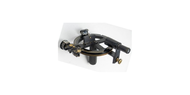
The developments of the nautical sextant were mainly related to astronomical positioning (latitude and longitude from heavenly bodies). Parallel to this development the sextant found employ in hydrographic surveying. Where early hydrography was mainly concerned with coastlines and discoveries, the science came into its own right in the 18th century. In that century scientific methods were developed to enhance the accuracy of charts and add more depth measurements to allow safe navigation.
A good example is the founding of the French ‘Depot des cartes et plans de la Marine’ in 1720 and the English ‘Hydrographic Office’ in 1795. Of course, companies such as the Dutch and English East India Companies had been charting for much longer. However, their charts were often kept secret or, when published, not updated. To enhance the safety of navigation, more detailed and up to date charts were required. For this purpose, many depth measurements had to be taken resulting in formalized hydrographic surveys as we still know them today.
Early surveys were often performed as ‘running surveys’ where the start- and endpoint of the survey was determined astronomically and the positions in between from dead reckoning using the compass heading and (estimated) distance travelled. This method did not give very accurate results for the increasing requirements from navigation.
Early sextants for horizontal positioning
In 1765 John Mitchell wrote that the Octant was to be preferred above the compass [1] for determining horizontal angles. In 1771 Alexandre Dalrymple (the first British Hydrographer) stated [2] that the Hadley Quadrant was to be preferred over the compass in terms of accuracy and ease of use. The downside of the Hadley Quadrant was however still, that it could not measure large angles. In 1774 Murdoch Mackenzie (Sr, 1712–1797) writes that a brass sextant of 9” radius (120°, ca 23 cm) is more suitable for this task next to an 18” radius octant [3]. As far as can be determined his cousin, (Lt. Murdoch MacKenzie Jr) first applied this method during a survey of the Thames river in 1774. Earlier surveys in 1772 and 1773 show significantly less depth measurements, an indication that position determination was harder than at the later Thames survey [4].
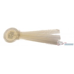
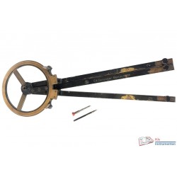
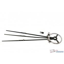
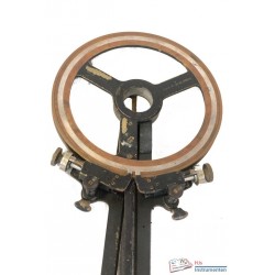
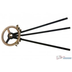
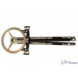
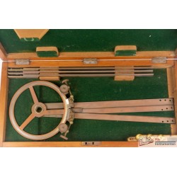
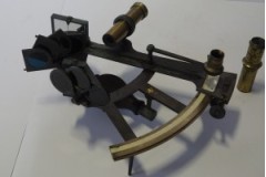
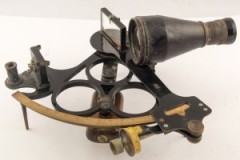
The first ‘true’ survey sextants appear during second half of the 19th century (apart from the double sextants as described) [5]. These differ from their astronomic family members in that they usually do not have filters to block out the sun, have relatively large mirrors and a large telescope to make as much use as possible of any light. Another design item that often sets them apart is their second set of ‘legs’ allowing the user to place the instrument ‘upside down’ to allow quicker changes between notating angles and measuring them. Technically most of these are quintants (140°) rather than sextants, allowing the known points or beacons to be placed further apart. Most of the early survey sextants are of British origin, whereas in France and Italy the reflecting sextant is commonly found for the same purpose. There are very few early survey sextants designed by other nations known.
Later sextants for horizontal positioning
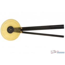
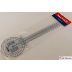
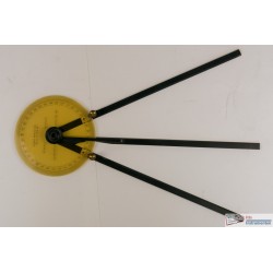
During the 20th century the various hydrographic services started to use specialized sextants more often although even then nautical sextants were used for the same purpose. An important addition on many later survey sextants was a 90 degree prism, allowing the sextant to theoretically measure angles up and over to 200 degrees. The placement of these prisms was usually in such a place that when looking over the horizon mirror to what is normally the horizon, the image is reflected 90 degrees 'left' in the prism. A survey sextant by Hughes and Son has a different arrangement with the prism just in front of the telescope. Until today the survey sextant can be bought including a prism [6] but in practice they are no longer used other than in training as most GNSS devices will give similar results without the need to set out three points for measurement..
Sources
- [1] John Mitchell, A recommendation of Hadley's quadrant for surveying, especially the surveying of harbours, together with a particular application of it in some cases of pilotage, 1765
- [2] C.F. Beautemps-Beaupré et al., Essay on the most commodious methods of Marine Surveying, Alexandre Dalrymple, 1771; Appendix to 'An Introduction to the practice of Nautical Surveying and the construction of sea-charts', 1823, p. 67 ff.
- [3] Murdoch MacKenzie, Maritim Surveying, 1774
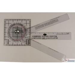
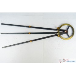
- [4] Susanna Fisher, The station pointer. International Hydrographic Review 68, 1991, 119 ff.
- [5] W.F. Mörzer Bruyns & Richard Dunn, Sextants at Greenwich, 9259, 2009, e.g. HO Da.92 door William Beechey
- [6] Sextant | Cassens & Plath (cassens-plath.de)
Related Products
Leave a Reply


6 Comments
Since it was found that this chemical helps purchasers increase their muscular progress and endurance, a quantity of fitness-minded people have begun using it.With this in mind, it’s no wonder bodybuilders go for a Dbol cycle (or a Dbol and check cycle), to maintain these unwanted aspect effects at a minimal. If you’re selecting to do a Dbol only cycle, you can be increasing the risks,nonetheless.It will amplify the aesthetic effects of Trenbolone (even better vascularity and definition) whereas, at the similar time, you’ll be bulking up and dropping fat. This is a sophisticated cycle for customers who have already skilled Trenbolone’s harsh unwanted effects.Turinabol will usually be the primary or only anabolic compound for women, so it’s usually easier to gauge the exact results of this steroid.This just isn\'t a steroid that anybody is likely to make use of on its own in a cycle.It is greatest used alongside a minimal of one different steroid,corresponding to Testosterone, although more highly effective steroids are also appropriate.It’s the most tolerable and the least more likely to trigger virilizing symptoms at low to moderate doses.For women first treading into the world of AAS, Anavar is almost at all times the FIRST choice – and infrequently the only alternative for those desirous to keep away from virilization. 80mg to 100mg daily for eight weeks is an advanced Oxandrolone cycle, however extra so for the advanced person would be the addition of a quantity of other steroids in a powerful stack. The basic rule when planning a cycle is that the higher the Anavar dose is, the shorter the cycle you must be doing. Some like to live on the edge, while there are those of us who want to balance the advantages and dangers.I assume I’ll go to 8 weeks on Anavar if I’m taking no more than 50mg.These include high-fiber meals and meals rich in omega-3 fatty acids. Avoiding saturated fats is crucial, as is including plenty of cardio in your exercises. This makes the hair from every follicle thinner and shorter; over time, the follicle dies, which implies no more hair development. When this happens to thousands of follicles directly, you\'ll expertise dreaded baldness, and it generally happens in a well-known M-shaped sample on the top – therefore the name male sample baldness. Winstrol is a DHT-derived steroid,and unlike steroids which may be based on the testosterone hormone, DHT-based steroids cannot be converted into estrogen. This means Stanozolol comes with no estrogen-related unwanted effects at all.Many girls will find virilization is unavoidable, even at 3mg or under.There has by no means been permitted medical use of Superdrol, so we\'ve no medical dosage guides to observe. Given that Dianabol aromatizes to estrogen, Testosterone isn’t one hundred pc needed, so pairing it with one thing like Masteron or even Winstrol would make for a fantastic strength and recomping six week cycle.Like Anavar and Deca, Anavar and Dianabol can additionally be a little bit of a wierd mixture and one that very few folks truly use.Turinabol has a relatively lengthy detection time in the system, about six weeks, but this can range between individuals. This means after your last dose, Turinabol can show up in drug exams for about six weeks following.If you watch your sodium intake you possibly can minimize the fluid retention problems. But as you\'ll have the ability to see I was taking very low doses by the requirements of right now. I imagine that 50mg/day is pretty excessive if it is truly near 50mg of methandrostenolone.While it could not pack a huge punch like Superdrol or shred you down like Anavar, it just appears to make every little thing work that much better.Therefore, by stacking Turinabol with an androgenic steroid (like testosterone),we typically see users maintaining excessive ranges of DHT and nitric oxide production, lowering the risk of impotence.If used as a slicing cycle, an anti-estrogen may be used to prevent water retention from the addition of testosterone.Letrozole or anastrozole have been effective choices for our sufferers, efficiently inhibiting aromatization (the conversion of testosterone into estrogen).Testosterone is among the handiest bulking brokers, rising muscularity and power features. Cypionate and enanthate are frequent esters amongst bodybuilders, selling slow and regular but significant results.Nolva is type of an outdated compound and there are a number of newer and more effective merchandise that maintain water retention down and forestall gyno.This is why you’ll sometimes see post cycle remedy protocols with BOTH Nolvadex as properly as an AI (aromatase inhibitor similar to Arimadex, Aromasyn, Arimistane). It not only helps to relieve and stop joint pain but assists with the healing of tendons and ligaments as properly.Though these methodologies might have some cardioprotective results, it is safer to keep away from anabolic steroids for optimal cardiac health. It is due to this comparatively short half-life that customers are advised to dose it in a cut up dose style all through the day. Dianabol doses which are administered as soon as per day will undoubtedly lead to unstable blood plasma levels akin to peaks and valleys.Doses that exceed 5mg per day must be cut up up into no much less than two doses evenly aside throughout the day. For example, if a consumer is administering 40mg per day, this particular person would administer 20mg first thing within the morning and the remaining 20mg dose roughly 5 – 6 hours later in the day.References: Valley
With correct use and monitoring, Anavar can provide noticeable improvements in muscle dimension, energy, and total physique.One of the benefits of Andriol is that, in distinction to many other oral steroids, this one isn\'t poisonous to the liver as a result of it does not pass by way of the liver. While this is a benefit, for many users, the downsides will outweigh the dearth of liver toxicity, together with the excessive value of the product when considering the high dosages wanted to reap the most advantages.When it comes to Anavar dosage, much less can typically be more as a outcome of its mild nature and a decrease incidence of unwanted aspect effects in comparison with other anabolic steroids. By combining Testosterone and Anavar, customers purpose to see synergistic results that yield results greater than what can be achieved through the use of either compound alone. Rigorously monitoring the cycle\'s impact on the body, tuning workouts and nutritional regimens, and adhering to really helpful dosages maximize the cycle’s effectiveness and safety.Like Anavar, it helps to advertise fats loss and enhance muscle definition. When it involves chopping steroids, Clenbuterol is usually compared to Anavar.If the choice is between Masteron and Primobolan, most of us will go along with Masteron, which might (and should) be run at a lower dose. Higher doses of Masteron can outcome in excessive muscle tightening; 300mg per week of Masteron will present the best results for many customers.It’s one of many more expensive steroids, so if money is tight, this might be one you’ll have to skip in a long cycle. To get one of the best from Primobolan, you do have to take higher doses, and this, after all, pushes the price up further. As Quickly As you’ve injected, the ester begins to detach from the hormone, and where it\'s a lengthy ester, it can take per week or two earlier than the effects of the steroid kick in. It additionally takes longer to exit your system when you cease injecting, and this impacts whenever you begin PCT.Since both are hepatotoxic, it’s essential to limit cycle size (6 weeks max) and use liver assist. Nevertheless, Anavar just isn\'t an various to training or food plan self-discipline; it\'s a software to enhance a structured fitness lifestyle.That Anavar acts as a fat-burner is a widespread false impression within the fitness world, but it’s nonetheless capable of lowering body fat to some extent. The improve in muscle mass within the physique helps it burn more fat with every workout or sports activities apply session.Nonetheless, don’t discount the danger – your response and sensitivity ranges can vastly differ from the following user for some people. Stacking Anavar will nearly exclusively be for chopping and recomposition cycles for male customers. Females will typically use Anavar to achieve lean mass, as ladies will be far more aware of the anabolic effects of this steroid.Notably, it fans the metabolic flames, carving coveted physiques with diminished fatty veils.Some people develop a dependence on other substances—like alcohol or prescription medications—to counteract problematic unwanted side effects of steroids, similar to insomnia or heightened irritability. This self-medication approach can escalate substance use issues and additional jeopardize a person’s well being.Many people who abuse steroids gravitate towards stimulants like cocaine or Adderall to increase power and suppress urge for food.Side by aspect, you’ll need to work on increasing your energy and getting sufficient sleep to maximize the gains.It also scores high in security, as its DHT content guidelines out chances of conversion into estrogen while maintaining muscle development unaffected.With more than four decades of expertise in producing dietary dietary supplements, Hi-Tech Pharmaceuticals is one other name worth the trust. You’ll additionally get a strength guide within the package deal, which might help you determine the right dosage.In order to cut back the consequences of gynecomastia, a SERM such as Nolvadex could also be utilized on-cycle when the nipples begin to swell.The solely instance we have seen ladies avoid masculinization with this stack is by microdosing Winstrol.Respected sellers typically present lab stories or certificates of study that verify the purity and efficiency of their products.Anavar (Oxandrolone) provides a variety of benefits for each men and women in bodybuilding. It’s additionally necessary to notice that the size of your cycle will depend in your targets and experience level.One Other cause why some athletes could cycle steroids is to avoid detection during drug testing. And if you\'re on the lookout for alternatives to Anavar with TRT – that is authorized and safer – natural steroids are options I might actually beat my chest and advocate to you.Different folks really feel that natural steroids are a better various as a result of they aren\'t as likely to cause unwanted effects.They can assess your particular person circumstances, hormone ranges, and well being considerations to determine if it is acceptable for you and create a tailor-made plan.In some circumstances, the harm caused by anabolic steroids could be life-threatening.Gynecomastia (the enlargement of breast tissue in men) is a less frequent however potential issue, especially if an individual runs a protracted cycle of Anavar at greater doses or pairs it with different steroids.Cardiovascular well being can be at stake; poor ldl cholesterol readings over time might open the door to heart problems. Moreover, sturdy emotional reactions—like heightened anger or depressive episodes—may surface, complicating daily life and relationships.Regardless Of medical functions, Anavar is usually abused for its capability to build muscle and scale back physique fats.Such off-label use can spur dangerous reactions, so it’s important for anyone contemplating the drug to totally understand its potential advantages and risks.Trenbolone is another harsh compound that individuals typically react negatively to, despite its wonderful results.Ladies who respond nicely to testosterone enanthate will comment on a greater mood, a higher sex drive, and the unimaginable potential muscle positive aspects – properly past what a lady could naturally acquire.Hardcore feminine bodybuilders will positively speak of their almost masculinized physique with substantial muscle mass, definition, and really low body fats. Testosterone Enanthate is well tolerated by nearly all adult males, on situation that this is the primary male intercourse hormone that the physique is used to.Relating To performance, we take higher doses of testosterone than the body can naturally produce.In this case, you\'ve a number of AAS offering the anabolic activity, with testosterone enanthate used only for TRT.References: Valley md
It is important to search out the proper stability of dosage and length of cycle to attenuate the danger of unwanted side effects and maximize the advantages.It is essential to notice, nevertheless, that everyone’s body is completely different and that you may have to experiment with different dosages and timings in order to find what works greatest for you. Dianabol is a strong steroid, and it could be very important concentrate on the potential side effects before you start using it. If you would possibly be conversant in the appropriate mixtures, you could be sure that each cycle might be useful whereas causing your body the fewest possible problems after that.The two most common stacks are Dianabol with Deca-Durabolin and testosterone Enanthate with Dianabol.Either mixture, for optimum outcomes, needs to be accompanied by a high-calorie diet.The greatest approach to verify the standard of AAS and steroids bodybuilding is thru third-party lab testing. Respected sellers often present lab stories or certificates of research that verify the purity and potency of their merchandise.Careful monitoring of AAS dosages and cycles, underneath the steering of a healthcare skilled, might help decrease unfavorable results on joint well being.Moreover, high doses of testosterone, Dianabol, and Trestolone may also carry comparable dangers.They might help you pack on muscle mass, however not until you regulate your diet and exercise program to your new objectives.A newbie Anavar cycle starts with mg daily, but no extra than 280 mg per week,and is greatest to be used in combination with one of many Testosterone esters.This is a friendly contest prep stack suited to hardcore users and opponents. Whereas Clenbuterol suppresses the urge for food, Anavar can increase starvation in some customers. 80mg to 100mg every day for eight weeks is an advanced Oxandrolone cycle, but more so for the advanced user will be the addition of a quantity of other steroids in a powerful stack.Dianabol’s aromatase activity is average compared to many other steroids.Nonetheless, it is nonetheless notorious for inflicting fluid retention, which gives you a bloated look – not only in your physique but typically across the face.This bloating can come on very abruptly – typically in a single day – and offers a telltale sign to other people that you’re using steroids.There are undoubtedly other steroids which are much more harsh than DBol in relation to unwanted side effects, with this being one of the more manageable steroids.You will still wish to be alert to Dbol’s unwanted effects and be able to handle any that appear.While Dianabol is no longer utilized by athletes due to its potential unwanted effects, it\'s nonetheless popular amongst bodybuilders and weightlifters who use it for its muscle-building properties. Anadrol is named a powerful oral steroid, however it can’t match Dianabol’s potency when it comes to energy and strength. Dianabol is solely a extra powerful steroid than Anadrol on a milligram-to-milligram foundation, however some customers will nonetheless swear by Anadrol, giving them better energy gains.Therefore, it’s by no means suggested to devour alcohol whereas using this steroid.Apart From, alcohol will slow down your efficiency and set your outcomes again, making using steroids a waste of time, which is an efficient purpose that critical bodybuilders and athletes keep away from it.Dianabol is classed as a Schedule III controlled substance within the US, and it\'s towards the law to purchase Dianabol or use it in most international locations.Additionally, customers could experience mood swings and aggressive conduct.One of the necessary thing reasons bodybuilders utilize Dianabol is for its unparalleled capacity to facilitate clean bulking and muscle gain cycles. Equipoise (EQ or Boldenone undecylenate) is certainly one of the other compounds we are ready to use, predominantly on a bulking section. Known as the compound you should run for at least 10 weeks before the results really turn into noticeable. EQ was initially used predominantly for horses, and that’s why you;ll usually hear folks discuss with it because the Veterinary Steroid.EQ is also usually described as a \"dryer\" Deca Durabolin, and that isn’t exactly 100% true. The huge determining factors are still going to be genetics, training, and naturally food plan.Whereas it is possible to search out Dianabol on the market on-line, it may be very important be conscious of the potential dangers involved in buying steroids illegally. It is because of this comparatively short half-life that customers are advised to dose it in a cut up dose style throughout the day. Dianabol doses which are administered once per day will undoubtedly result in unstable blood plasma ranges akin to peaks and valleys.Doses that exceed 5mg per day should be split up into no much less than two doses evenly apart throughout the day. For example, if a consumer is administering 40mg per day, this person would administer 20mg very first thing within the morning and the remaining 20mg dose approximately 5 – 6 hours later in the day.As a fitness trainer with a PN1-NC certification, I typically have clients and fellow health club fanatics tempted to fast-track their positive aspects by utilizing anabolic steroids like Dianabol.Decide for a Dbol solely cycle, and you’re restricted to 4-6 weeks before you want to cease. Stack Dianabol with different steroids, and you can take pleasure in a longer cycle, as you’ll be succesful of use Dianabol to kick-start the first 4 weeks of your cycle, before finishing it with another testosterone. Now, if you’re fairly severe about bodybuilding, you’ll have most likely already heard a quantity of names on the grapevine. Nicely, today our aim is to enlighten you about Dianabol (Dbol) cycles, and how it might be used to help both novice and advanced fitness center customers.So whereas following a steroid cycle might appear to be a complete pain within the ass (quite actually in phrases of injections!), your body will profit from a break. If you’re taking steroids for the first time, the day by day really helpful dosage is 15-30mg each day. Taken for as much as 6 weeks, if you’re a beginner in relation to steroids, that is plenty.Don’t stray from the 6-week mark, however, as this will lead to critical side effects. Though Dianabol (Dbol) won’t bulk you up overnight, after a quantity of weeks you’ll really begin to really feel its results come into play. Dbol is an oral anabolic steroid, taken often as an additional steroid somewhat than merely on its own.References: Valley
Testosterone is the base of most cycles as it\'s going to convert to Estrogen at a great rate (which is required for health) and it\'ll still result in some very good features. You must just be sure you are consuming enough calories and getting enough rest. When selecting a Dianabol replacement, it could be very important think about your goals and preferences.If you might be on the lookout for a powerful anabolic steroid that can help you bulk up shortly, then D-Bal is an efficient choice.Secondly, begin with a decrease dosage and enhance it progressively over the course of a number of weeks.It’s essential for girls to be vigilant about monitoring their our bodies for any indicators of virilization and to regulate the dosage accordingly.Customers taking Dianabol have reported significant dimension positive aspects, particularly during their first steroid cycle. Arnold Schwarzenegger, a legendary bodybuilder and former Mr. Olympia, has been open about his use of Dianabol throughout his profession. He, like many others, experienced vital muscle-building and bulking effects from this powerful oral anabolic steroid. Ladies participating in bodybuilding should be notably cautious when contemplating using Dianabol.The androgenic results of this steroid can lead to the event of male characteristics, similar to deepening of the voice, facial hair development,and physique hair development. Consequently, other, much less androgenic, anabolic steroids are generally more appropriate for feminine athletes.Like many AAS, Equipoise was first developed to deal with conditions like muscle losing and osteoporosis.Medical use of EQ in people stopped during the Nineteen Seventies, but this steroid is still used within the veterinary area right now in horses.Boldenone is prescribed for veterinary use in horses to extend the appetite and influence the conduct of female and castrated male horses[1]. Most steroid customers are conversant in the legendary compound Dianabol, which EQ shares a nearly equivalent chemical construction with.Nonetheless, a slight modification permits each one to have a different effect on the physique. This makes it possible to use these very related but completely different-acting steroids collectively in a cycle with nice benefit.If you don’t full a PCT, your T levels will cease, resulting in low temper, fatigue, lack of libido and poor sexual performance. This liver support supplement is pretty widespread within the bodybuilding world to attenuate the results of Dbol on the liver.Since there are so many dangers concerned and Dbol requires true dedication to take care of, a Dianabol cycle is best suited to really superior bodybuilders.This is the frequent \"bulking\" cycle, and might definitely result in you constructing some critical size. For most males, a dosage of mg per day for eight weeks will produce noticeable outcomes.Nevertheless, it is at all times best to consult with a health care provider earlier than starting any kind of steroid cycle.This might lead to unwanted unwanted side effects, such as hair loss, acne, and Gynecomastia (the development of breasts in men).Some girls might want to go further and add one other two weeks to the cycle whereas increasing the dosage for those final two weeks up to 20mg every day, but monitor for any potential side effects. Lean muscle features will differ considerably among ladies, but over a 6-week cycle, some females can see glorious features of up to 5-10lbs,even while shedding some body fats. Testosterone Enanthate is a long-lasting ester that can be used for a 12-week cycle alongside Anavar.It can dry out your physique, promote unbelievable muscle hardening, and allow for a really dry, lean, and shredded body best for contests or private goals. Ideally, you’ll be at a low body fat level before utilizing Anavar to get pleasure from its maximum physique enhancement effects.I would additionally like to know the way different AAS will deliver further benefits to a stack.It’s also fascinating to match Dbol to different oral steroids as we can see how unique it\'s (with most different orals being dry-cutting steroids).It is extensively beneficial that women don’t use Dianabol as a end result of virilization is nearly certain to happen.Whereas it\'s attainable to seek out Dianabol on the market on-line, you will need to be conscious of the potential risks involved in buying steroids illegally. It is because of this comparatively short half-life that customers are advised to dose it in a break up dose trend throughout the day. Dianabol doses which are administered as soon as per day will undoubtedly lead to unstable blood plasma levels akin to peaks and valleys. Doses that exceed 5mg per day should be break up up into a minimal of two doses evenly aside throughout the day. For example, if a consumer is administering 40mg per day, this individual would administer 20mg very first thing in the morning and the remaining 20mg dose roughly 5 – 6 hours later in the day.References: Valley
For a deeper dive into risks, consult this beginner-focused health evaluation. Beginning at a low dose permits the body to adapt and minimizes aspect impact dangers. Given the choice between Dbol solely cycles and Dbol and check cycles, the clear winner needs to be possibility 2 (although, if given a 3rd possibility we\'d use neither because the risks are just too many).Now with any of these Dbol cycles, you should at all times consider including liver assist supplements – milk thistle, Liv-52 or Alpha Lipoic Acid – to your regime.These can ease the effects of Dianabol in your liver and limit the quantity of injury it could cause.Anadrol’s androgenic rating is about half that of testosterone, but there are other methods androgenic unwanted effects can rear their ugly head.Whereas Anadrol doesn’t convert to estrogen, estrogenic side effects aren\'t solely attainable with this steroid however could be fairly severe. This is due to direct stimulation of the estrogen receptors rather than aromatization. Trenbolone will depart long-lasting metabolites in your system and potentially shut you down for many months. Regular PCT may not work successfully after this cycle, and ongoing testosterone cruising is often needed.Deca will go away long-lasting metabolites in your system and doubtlessly shut you down for a lot of months.There are a quantity of ways to mix these two, but I like Anadrol as a kickstart when using a medium to slower-acting testosterone.Begin with 300 mg of it on the primary day of biking cut up into three intakes. Dianabol just multiplies the Trenbolone motion on the body helping to get stronger and bigger at a lower dosage.Hence lowering not only the overall cost of the cycle ( lower dosages) but also the vary of unwanted effects that can be encountered. It suppresses and even shuts down the natural production of testosterone inside the body.While it\'s potential to find Dianabol on the market on-line, it could be very important concentrate on the potential risks concerned in buying steroids illegally.It is because of this relatively quick half-life that users are advised to dose it in a break up dose trend throughout the day. Dianabol doses that are administered as quickly as per day will undoubtedly end in unstable blood plasma ranges akin to peaks and valleys.Doses that exceed 5mg per day ought to be break up up into at least two doses evenly aside throughout the day.For example, if a user is administering 40mg per day, this particular person would administer 20mg first thing in the morning and the remaining 20mg dose approximately 5 – 6 hours later in the day.Schwarzenegger emphasized the importance of the mind-muscle connection, specializing in contracting and feeling the goal muscle tissue working throughout every repetition. This strategy helps to maximise muscle fiber recruitment and engagement,enhancing the effectiveness of every train for hypertrophy.As an intermediate steroid consumer, Dbol dosage goes up to 50 mg per day as aforementioned. In The Meantime, superior people are free to pick the dosage they assume is extra productive for them, as they know what they do.To obtain the very best outcomes when using Dianabol, it is important to combine the anabolic supplement with correct diet and coaching.Users taking Dianabol have reported vital measurement features,especially throughout their first steroid cycle. Arnold Schwarzenegger, a legendary bodybuilder and former Mr. Olympia, has been open about his use of Dianabol throughout his career. He, like many others, experienced significant muscle-building and bulking results from this powerful oral anabolic steroid. Ladies partaking in bodybuilding should be significantly cautious when considering using Dianabol.The androgenic effects of this steroid can lead to the development of male characteristics, such as deepening of the voice, facial hair growth, and physique hair progress.Consequently, other, less androgenic, anabolic steroids are usually more appropriate for feminine athletes.Dianabol also can negatively have an result on users\' mental well being due to significant reductions in dopamine and muscle atrophy occurring post-cycle, inflicting strong dependence or habit in some people. Dr. Ziegler created Dianabol, a compound that is more anabolic than testosterone and less androgenic.Thus, prostate points had been less of a concern, as had been male pattern baldness and zits vulgaris on Dianabol.The greatest way to verify the quality of AAS and steroids bodybuilding is thru third-party lab testing. Reputable sellers typically provide lab reports or certificates of research that verify the purity and efficiency of their products.Cautious monitoring of AAS dosages and cycles, underneath the steerage of a healthcare skilled, might help reduce negative effects on joint well being. Additionally, excessive doses of testosterone, Dianabol, and Trestolone can also carry comparable risks. They can help you pack on muscle mass, however not until you adjust your food plan and workout program to your new objectives.A beginner Anavar cycle starts with mg day by day, however no extra than 280 mg per week, and is best to be used in combination with one of many Testosterone esters.Many individuals report with the ability to add pounds to their bench press and squat during a cycle. When used properly, Dianabol may be an effective tool for bettering athletic performance.Dianabol is a strong drug, and it might be exhausting on your liver and other organs.Dianabol has a half-life of solely 3-5 hours, so it must be taken a quantity of occasions throughout the day.Due To This Fact, it’s important to make use of it responsibly and cycle off every few months. In this weblog publish, we\'ll focus on the perfect Dianabol cycle size, dosage, and results you probably can anticipate.If you\'re looking to enhance your physique composition and performance in the fitness center,you may have considered using Dianabol.References: Valley
how safe are steroidsReferences: oren-expo.ru